The Real Lonely Islands
The world is full of wonders—and while some are just within our reach, there are some truly fascinating remote places on Earth, including islands that are so far away you’d wonder just how they came to be discovered in the first place.
Some can be visited, while others are deserted. Some are tropical, while others are icy cold. But they all share certain characteristics: extreme isolation, rugged coastlines, and breathtaking landscapes.
How Far Are They Really?
Just how remote are these islands? Though we’ve mentioned how far they are from the nearest mainland, their “remoteness” can’t just be measured by that. It’s also measured by how far one needs to travel to reach them, and how difficult the journey is.
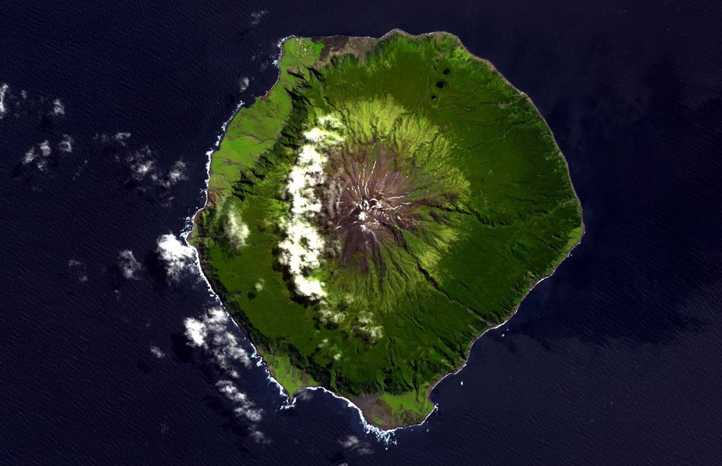
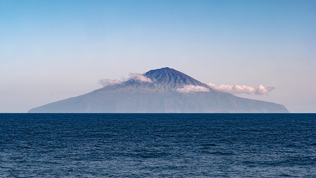
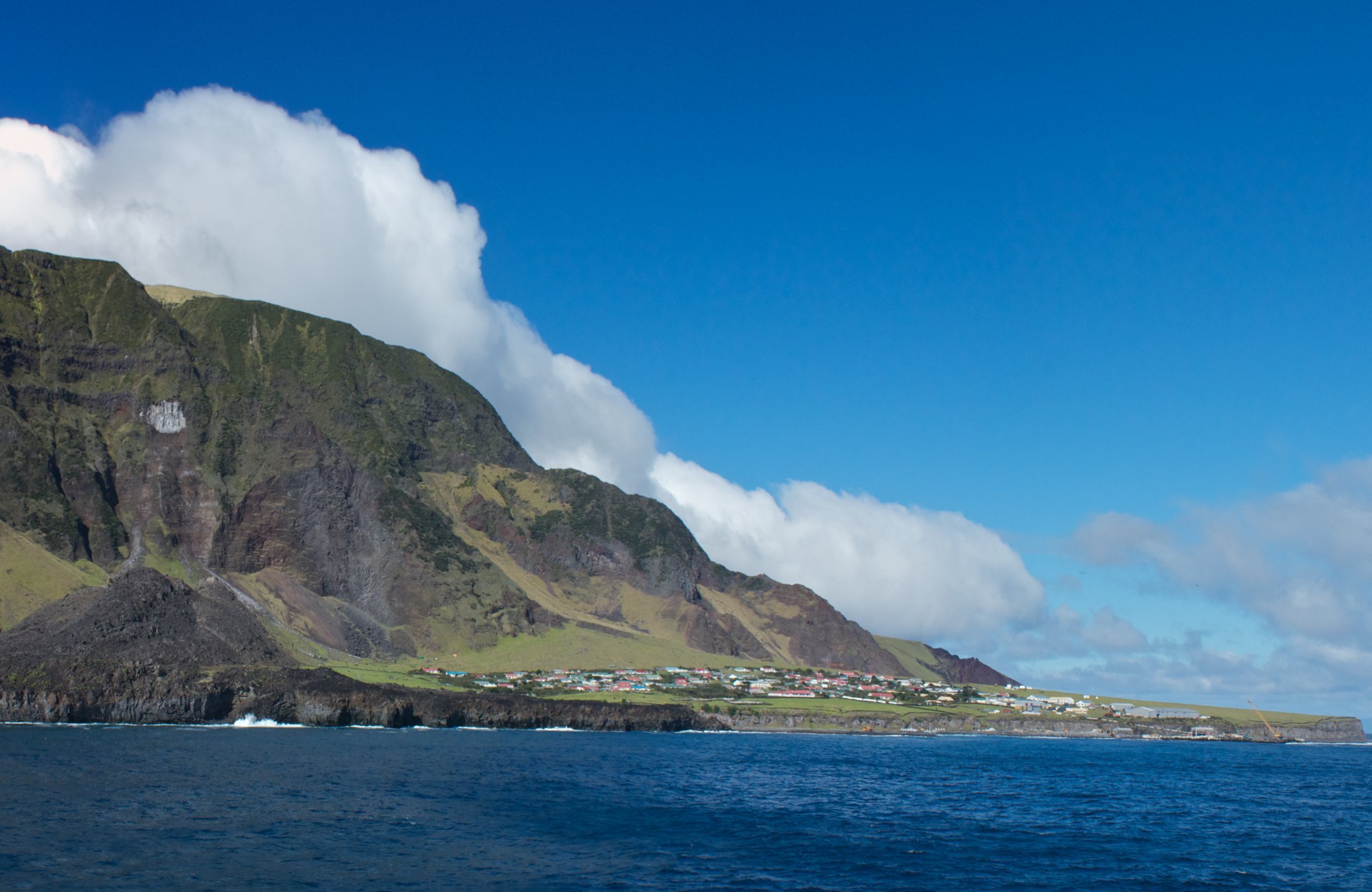
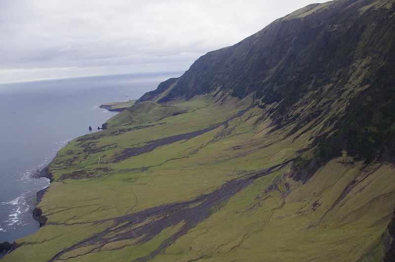
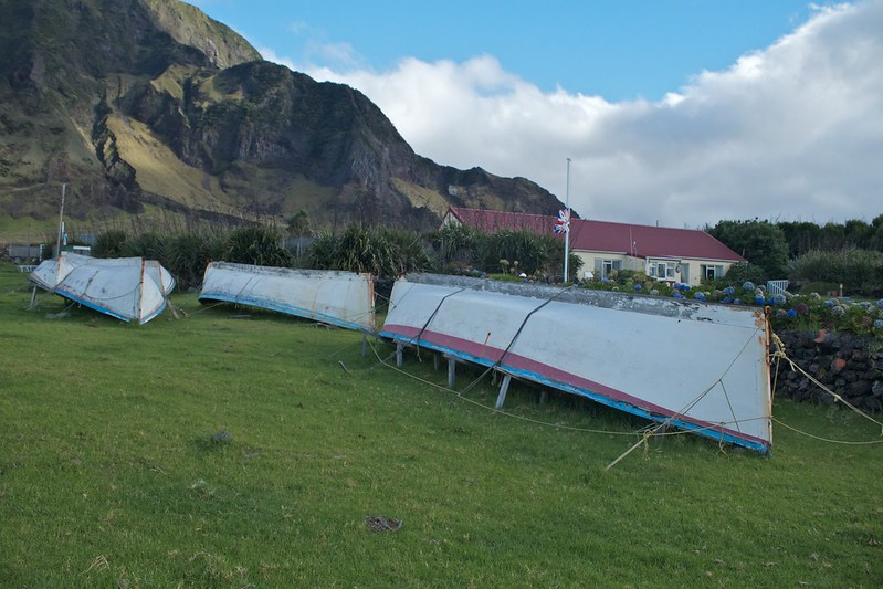
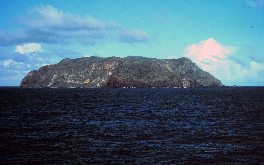
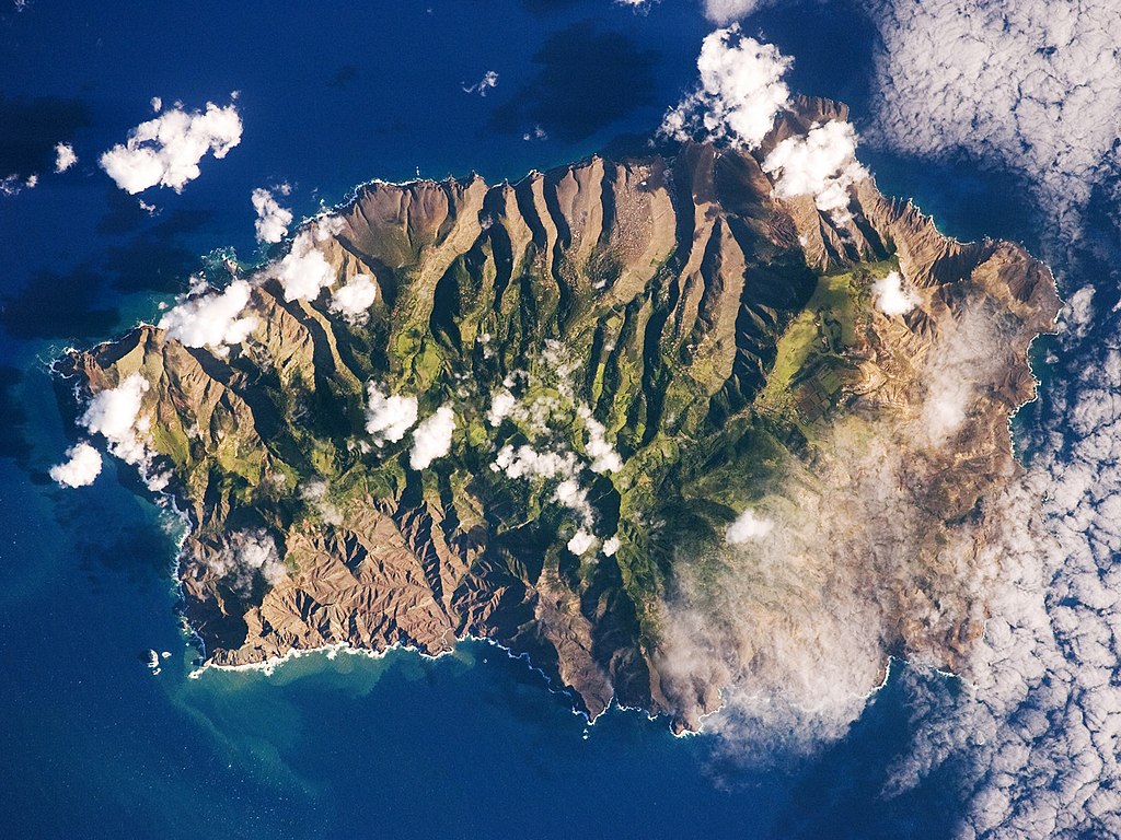
Tristan da Cunha
2,787 km (1,732 mi) from Cape Town, South Africa
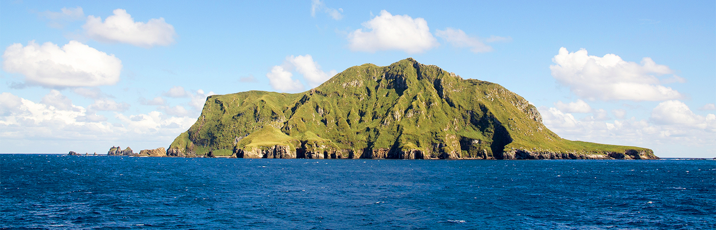
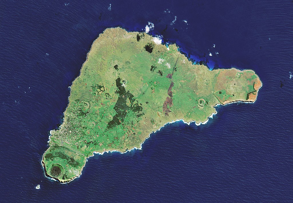
The most remote inhabited archipelago in the world, Tristan da Cunha is a remote group of volcanic islands in the South Atlantic Ocean. Though its closest neighbor is St Helena, that island is, spoiler alert, also one of the most remote islands in the world. It’s a British Overseas Territory consisting of the main island, Tristian de Cunha, which has some 250 inhabitants, and other, uninhabited islands: Gough Island, Nightingale Islands, and the appropriately-named Inaccessible Island.
Tristan da Cunha History
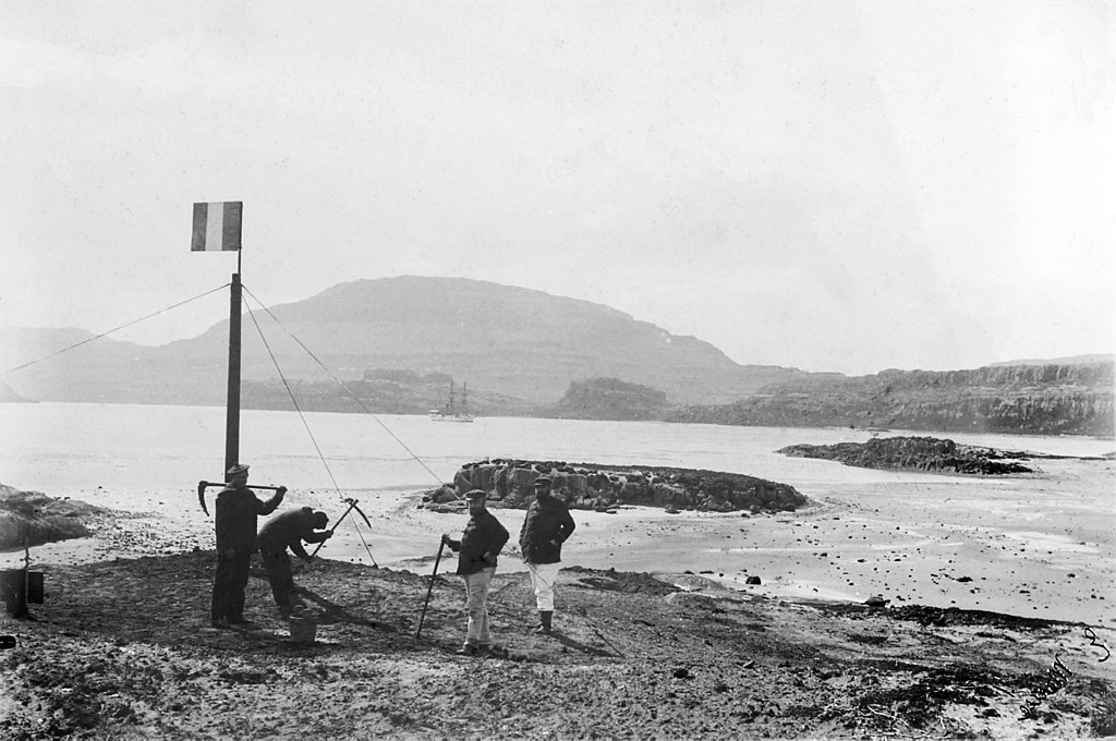
The islands are named for the explorer who first reported spotting them in the early 16th century, Tristão da Cunha. A number of explorers, from Portuguese to Dutch to French. Their history is intertwined with that of “nearby” Saint Helena, where Napoleon was exiled. The UK annexed Tristan da Cunha to ensure no one would use it as a strategic point to try and free the deposed leader.
Though the population had to be evacuated in 1961 due to a volcanic eruption, most returned after two years. Today, most of the island’s approximately 250 inhabitants are descended from a small group of Europeans settlers and mixed race travelers from Africa, Asia, Europe, and even Saint Helena.
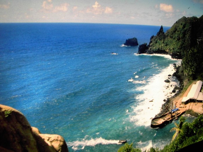
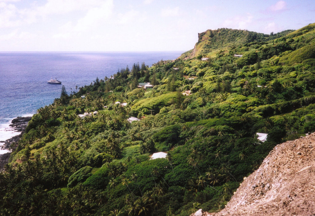
Tristan da Cunha Features
The islands are marked by towering volcanic peaks, incredible biodiversity, and a wet yet temperate climate. The people of Tristan da Cunha live in one settlement, which happens to be the only flat area: Edinburgh of the Seven Seas, where they support themselves by farming and fishing. Interestingly, there’s only a single policeman on the island—and there’s never been an arrest.
 Brian Gratwicke, Wikimedia Commons
How To Get To Tristan da Cunha
There’s no airstrip to fly into Tristan da Cunha—and although “neighboring” St Helena has one, it’s nearly the same distance from there as to South Africa. What does that mean? Well, if you want to visit the most remote island in the world, you’re looking at a six-day journey by ship. To make things even more difficult, there are only 10 sailings a year. They run between $800 and $1,500 round-trip, which actually doesn’t seem that expensive considering the distance and labor involved.
Staying In Tristan da Cunha
Even if you were to find the time to book the journey, your trip would need to be approved by an island council before they let you set foot on land. Additionally, tourism really isn’t their industry. As their website explains, “There are no package tours for independent travelers, no hotels, no airport, no holiday reps, no night clubs, no restaurants, no jet skis nor safe sea swimming.”
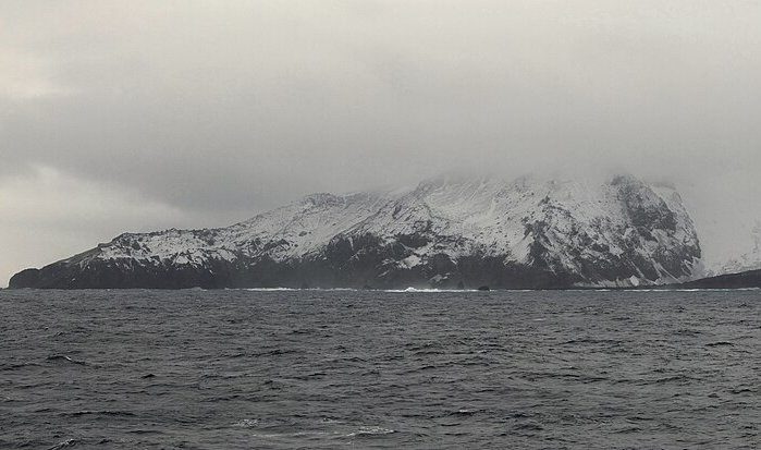
Bouvet Island
1,700 km (1,100 mi) from Antarctica
While Tristan de Cunha is inhabited, the next entry on the list, Bouvet Island, is as desolate as it gets. It’s a subantarctic volcanic island, that while technically also located in the South Atlantic Ocean, is so, so, far from civilization, including Tristan da Cunha. If you were to look at the bottom of a globe, it’s north of Antarctica, and about 2/3 of the way between South America and Africa.
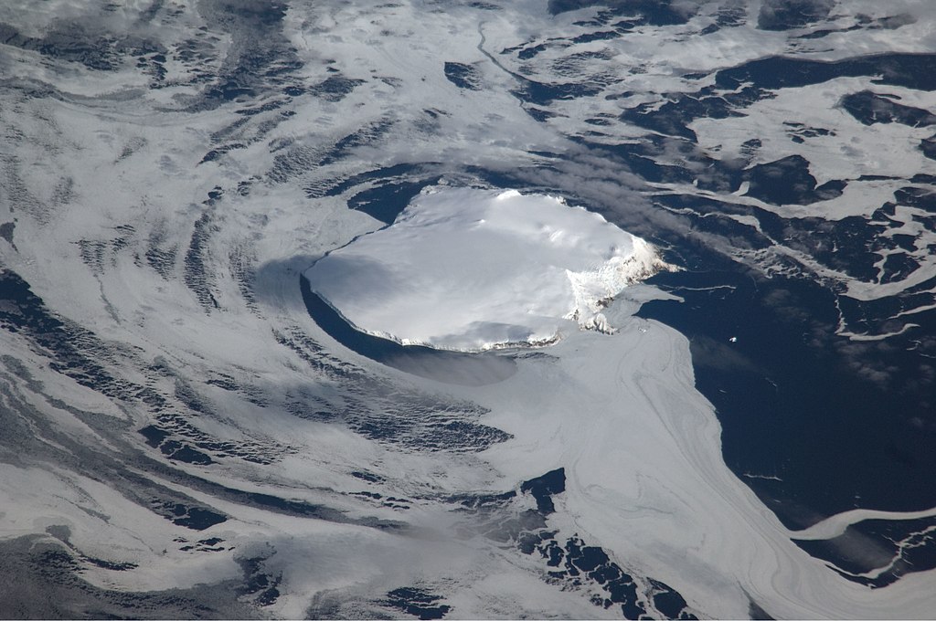 International Space Station crew, Wikimedia Commons
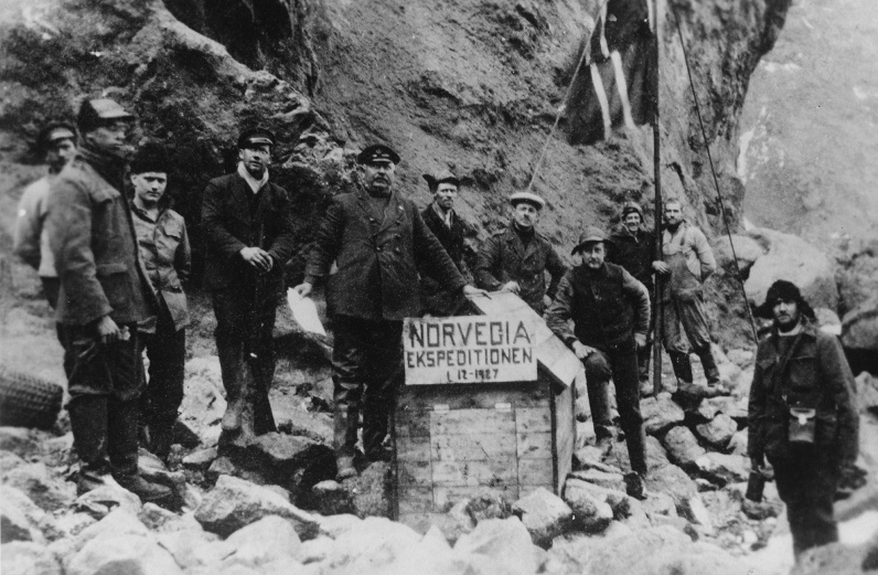
Bouvet Island History
French sailor Jean-Baptiste Charles Bouvet de Lozier made the first reported sighting of the island in 1739, though his team didn’t make landfall. Over the years, many others laid claim to the land until finally, a Norwegian expedition made landfall in 1927 and disputed those claims, Ultimately, they won, and it became a Norwegian dependency in 1937 and a nature reserve in 1971.
 Unknown Author, Wikimedia Commons
The Vela Incident
Though uninhabited, Bouvet Island has seen its share of mysterious occurrences. In 1964, a visiting British naval ship found an abandoned lifeboat, but couldn’t find any evidence of people who would have potentially been on it. Then, in 1979, a US satellite recorded an unexplained double flash, a form of nuclear phenomena. Though some have claimed it was a glitch or a meteor, many believe it was a secret nuclear test performed jointly by South Africa and Israel.
 François Guerraz, CC BY-SA 3.0, Wikimedia Commons
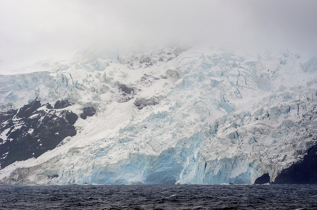
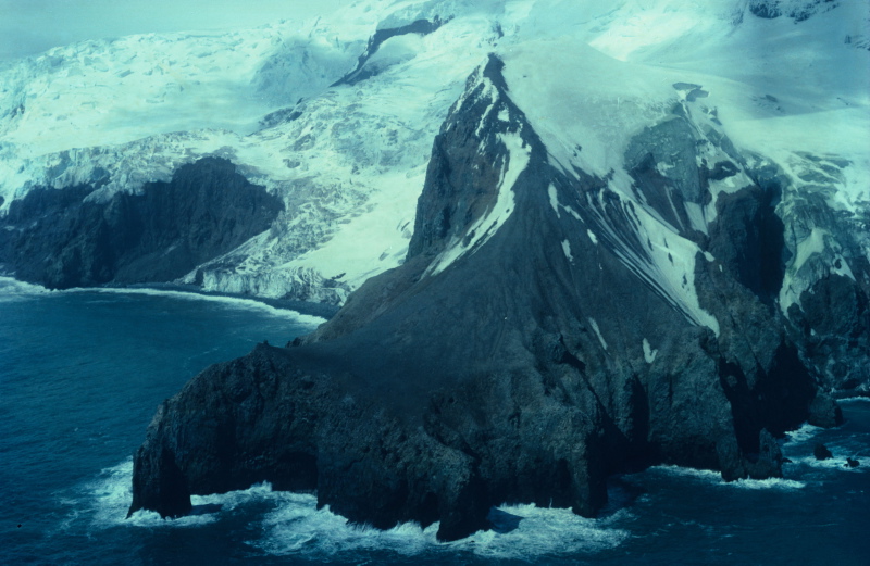
Bouvet Island Features
Bouvet Island is understandably uninhabited—it’s quite inhospitable, with Antarctic temperatures, sheer cliffs, and ice fields. Despite this, it’s home to a number of seabirds and marine species, including albatrosses, penguins, and seals. In the waters nearby, a variety of different whale species flourish, as the area is rich with krill.
 1447, CC BY-SA 3.0, Wikimedia Commons
How To Get To Bouvet Island
In short: you don’t. You’d have to in some way be qualified to visit a nature preserve and get permission from the Norwegian authorities. If you can do all that and fund a research project, there is one small area where a helicopter can be landed.
 François Guerraz, CC BY-SA 3.0, Wikimedia Commons
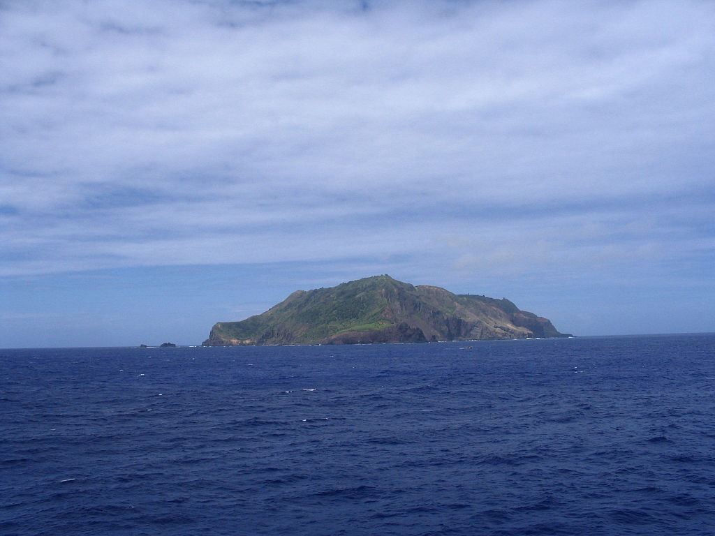
Pitcairn Islands
5,300 km (3,300 mi) from New Zealand
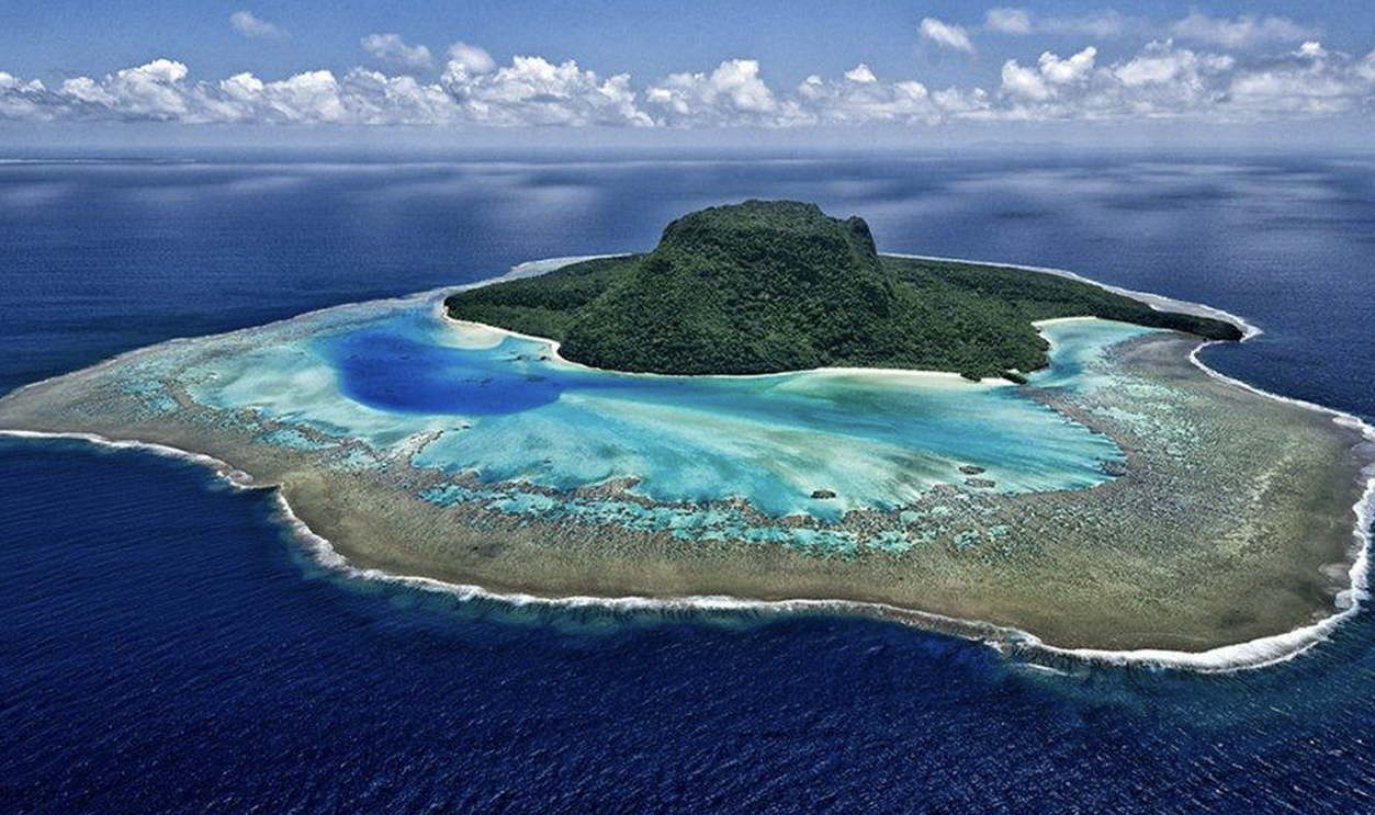
The Pitcairn Islands are a group of volcanic islands in the middle of the South Pacific, nearly equidistant from both New Zealand and Chile. The group is made up of four islands: Pitcairn, Henderson, Ducie, and Oeno Islands. They are the only British Overseas Territory in the Pacific Ocean. Though it became a British colony in 1838, there were people on the islands long before that.
 wileypics, CC BY 2.0, Wikimedia Commons
Pitcairn Islands History
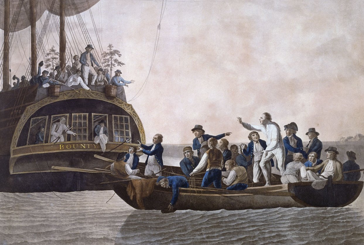
A group of people, most originally from Polynesia, lived on the island for four centuries before they abruptly disappeared, likely due to deforestation and civil conflict. The infamous mutiny on the Bounty then brought a new group of inhabitants to Pitcairn: fugitive castaways who’d picked up a group of Polynesian men and women along the way.
 Robert Dodd, Wikimedia Commons
A History Of Mutiny
Before long, the Polynesians were orchestrating their own mutiny against the former Bounty crew. Years of paranoia and unrest followed, until they were able to form a functioning—and even flourishing—society. Contact was re-established with the British, and the Pitcairn Islands eventually became a colony.
 Makemake, CC BY-SA 3.0, Wikimedia Commons
Pitcairn Island Modern History
In 2004, the Pitcairn Islands were rocked when 13 current and former residents were charged with sex-related offenses—including the mayor and magistrate of the Islands. Six were convicted, and the British government had to actually establish a penal institution on the Islands so they could serve their sentences.
History repeated itself in 2010 when another mayor found himself in hot water for similar reasons.
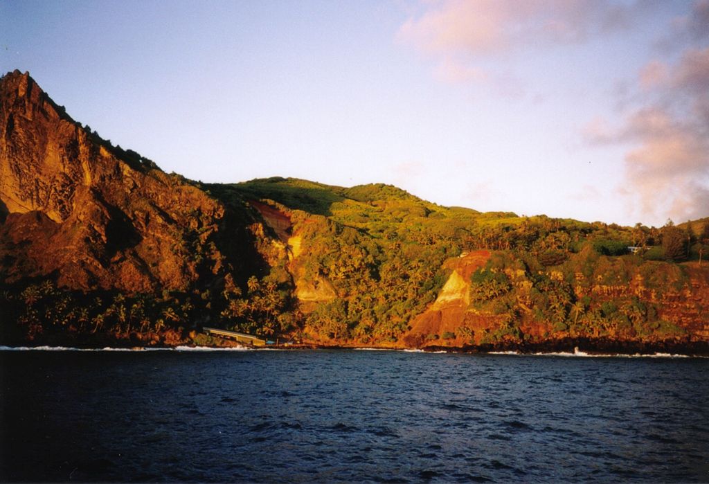
Pitcairn Islands Features
Though the Pitcairn Islands are absolutely stunning, they are hard to access. There is just one shallow harbor on the main island, while the rest is marked by extremely rocky shorelines and cliffs. This is just one breathtaking side of the Pitcairn Islands, which are otherwise green and lush. The islands have warm weather all year round and rich biodiversity of fauna, birds, and marine life.
 Makemake, CC BY-SA 3.0, Wikimedia Commons
How To Get To The Pitcairn Islands
The population of the Pitcairn Islands as of 2021 was 47 people, and the primary sources of income for the island are landing fees and tourism. Small groups are welcome to charter a vessel to visit. Otherwise, there are ten day-trip landings a year by expedition cruise ship. And, since 2019, the government has operated a vessel to bring tourists to the islands weekly.
 Makemake, CC BY-SA 3.0, Wikimedia Commons
Staying On The Pitcairn Islands
Unlike Tristan da Cunha and Bouvet Island, you can not only visit the Pitcairn Islands—you can live there. If you have NZ$30,000 in savings and NZ$140,000 to build your own home, you can apply to move there. However, if that’s a bit much, tourists are welcome to come and experience a home stay with a local and learn about Pitcairn culture.
 Makemake, CC BY-SA 3.0, Wikimedia Commons
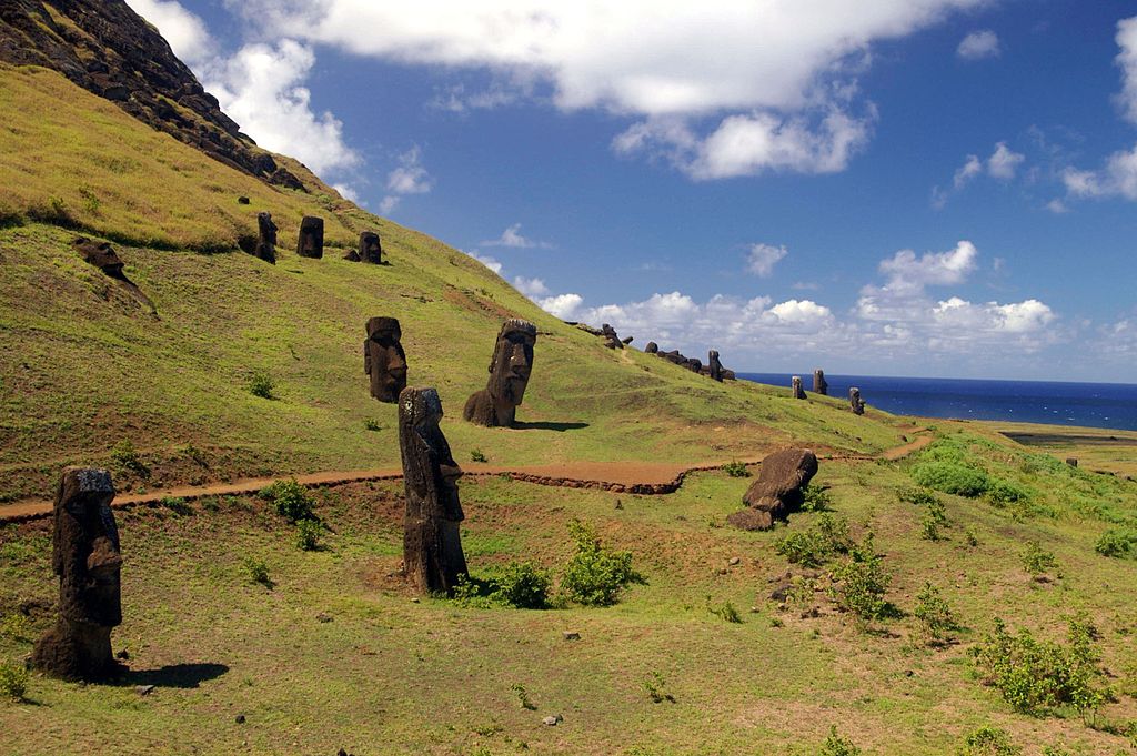
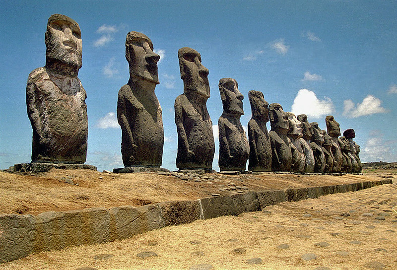
Easter Island
3,700 km (2,300 mi) from Chile
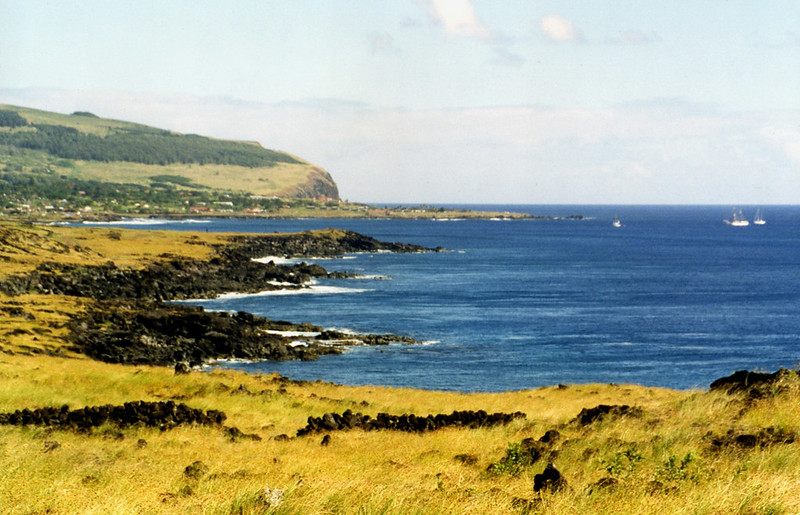
Though Easter Island is primarily a special territory of Chile, their closest inhabited neighbor is actually the previous entry on this list, the Pitcairn Islands. Easter Island does attract a lot of attention, despite its isolated nature, due to its famed—and mysterious—moai statues. The island is a World Heritage Site, and most of it is a protected national park.
 European Space Agency, CC BY-SA 3.0, Wikimedia Commons
Easter Island History
Though it was given the name Easter Island by a Dutch explorer, the Polynesian name for it is Rapa Nui, literally “Big Rapa,” due to its resemblance to another island named Rapa. According to oral tradition, a group of Polynesians from Cook Islands came, hoping to settle there, only to find one person already living on Easter Island. One of the Cook Islanders, Tu'u ko Iho, is said to be the one who brought the statues to the island.
 Rivi, CC BY-SA 3.0, Wikimedia Commons
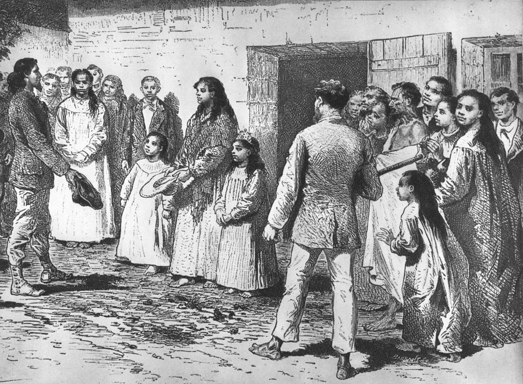
The Fall Of Easter Island
For years, a society of thousands flourished on Easter Island, until a combination of deforestation, European contact and disease, infestation, abductions by Peruvians, and civil conflict led to a depletion of the population. At its worst, only 111 people lived on Easter Island, in 1877.
 Émile Bayard, Wikimedia Commons
The Rapanui
Around this time, the Rapanui tribe who lived on the island came closest to extinction. Amid all the conflict and struggle over the island, the Rapanui ultimately ceded sovereignty over the island to Chile, and it’s been a Chilean territory ever since, though that didn’t solve their problems, and natives ended up being forced to work. Eventually, they gained more rights—and in the 60s and 70s, tourism began to forever change the face of Rapa Nui, AKA Easter Island.
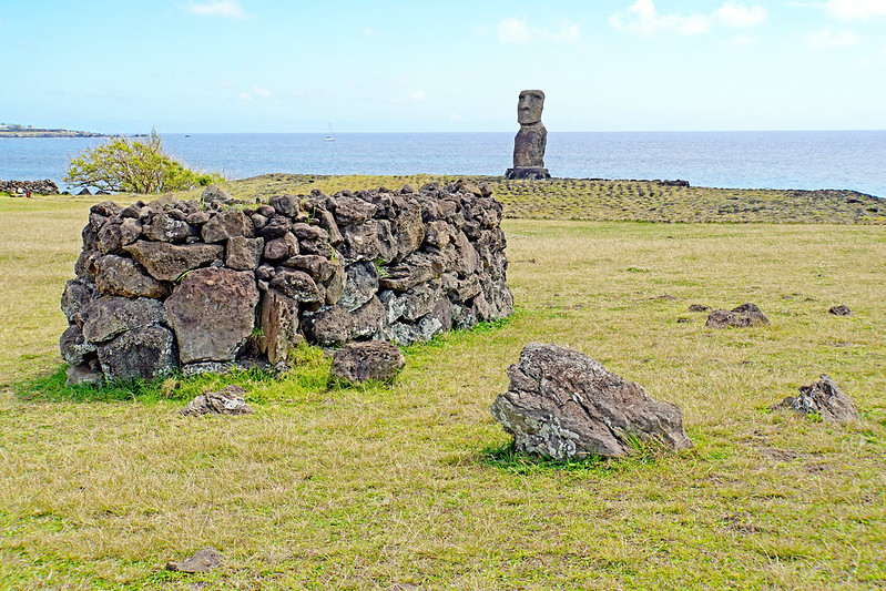
Easter Island Features
Easter Island is made up of three extinct coalesced volcanoes, and features three freshwater crater lakes, sandy shorelines, volcanic caves, and low, green vegetation covering the former peaks. It has a distinct ecoregion, called the Rapa Nui tropical broadleaf forests—tropical broadleaf forests being a type that once proliferated, but is now nearly gone. The Island used to be rich with native species of palm and birds—some 30—but due to human arrival, they are all now extinct.
 Bjørn Christian Tørrissen, CC BY-SA 3.0, Wikimedia Commons
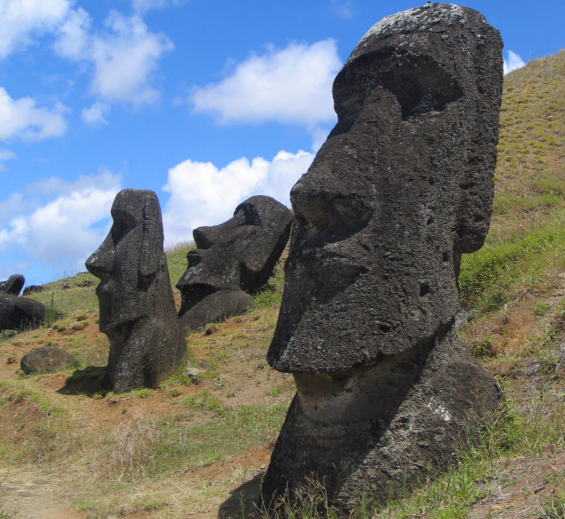
The Moai
We can’t mention Easter Island without getting into the moai, the distinct figural stone statues that look like big heads. Despite their appearance, many of them actually depict a full body—it’s just that they’ve been buried up to their necks by shifting soils over time. Carbon dating has put the creation of the moai somewhere between 1100 and 1680 CE. The current tally for the moai is at 887, though only a quarter were installed around the time of their creation, and many others languished in quarries for years.
How To Get To Easter Island
Unlike the other islands mentioned thus far, Easter Island not only has a large population (relatively), at 7,750 in 2017, but it’s also easy to get to. The island is home to Mataveri International Airport, which happens to be the most remote airport in the world. Once a flight is halfway to Easter Island, all other flights are cut off, since there’s only room for one plane on the island. The airport serves more than 100,000 visitors to Easter Island per year.
Staying On Easter Island
Easter Island’s natural beauty, warm climate, breathtaking beaches, and the allure of the mysterious moai have made it a popular tourist destination. However, before you get on your flight, you’ll need to show that you’ve booked accommodation at one of the island’s registered lodgings. All the hotels are in Hanga Roa, the only town, and can be expensive, especially compared to mainland Chile—but hey, what did you expect from what’s likely the most isolated tourist attraction in the world?
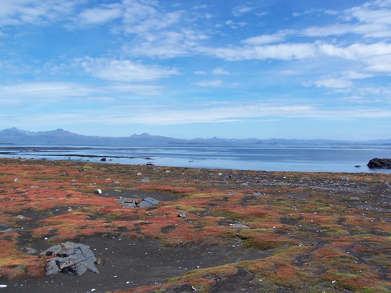
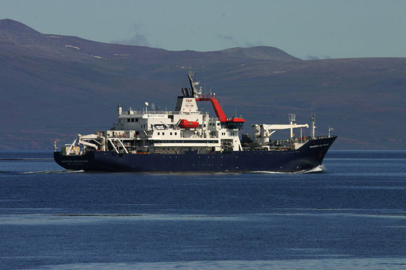
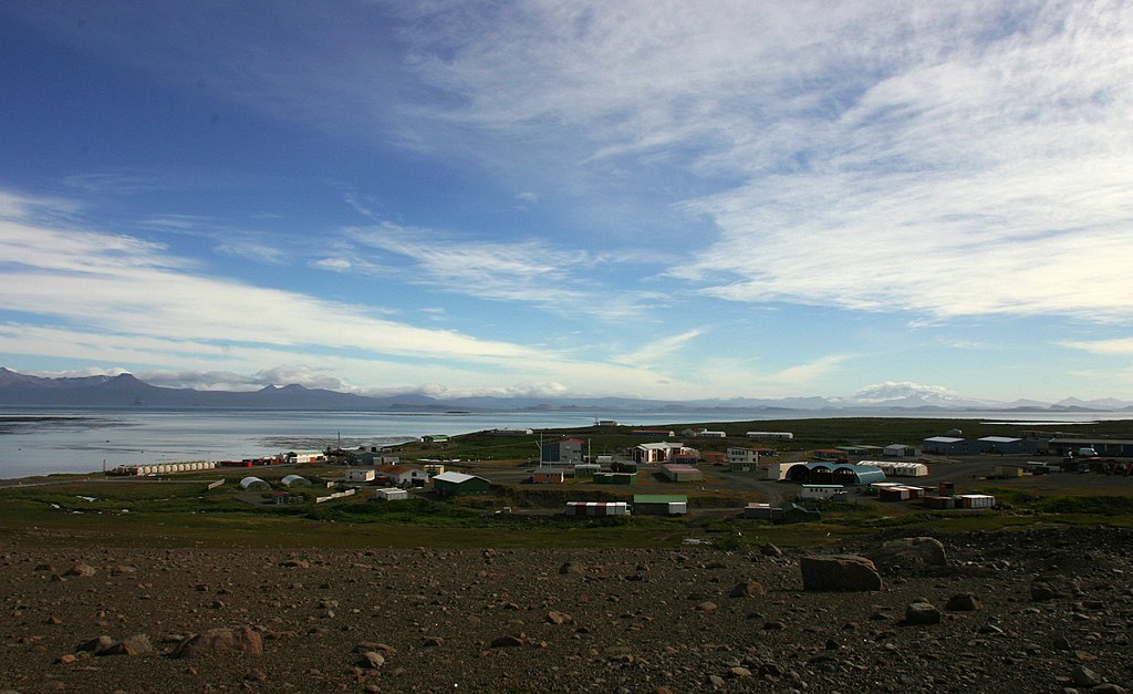
Kerguelen Islands
3,300 km (2,000 mi) from Madagascar
The Kerguelen Islands have an all-too-appropriate nickname: Desolation Islands. This isolated archipelago in the southern Indian Ocean is formed from volcanic rock and is typically uninhabited, save for research expeditions by scientists. This French territory consists of a main island, Grand Terre, and some 300 surrounding islands.
Kerguelen Islands History
The Kerguelen Islands were included in a catalog of the area’s lands before “officially” being discovered in 1772 by a French navigator. Upon news of the discovery, they were claimed for the French crown. Though many expeditions touched down briefly at the islands, including one by Captain James Cook, few people stayed long, unless they were there for sealing or whaling.
Since 1950, the island has been regularly inhabited by scientists, and usually maintains a population of between 50 and 100 researchers.
 Unknown Author, Wikimedia Commons
Kerguelen Islands Features
Grand Terre is home to Kerguelen’s highest peak, Mont Ross, as well as numerous fjords, coves, bays, and inlets. It has an incredibly harsh climate—icy cold, wet, and very windy. However, despite this, some fauna has flourished, including seals, penguins, and other seabirds, as well as marine life in the surrounding waters.
 Cousin jf, CC BY-SA 4.0, Wikimedia Commons
How To Get To The Kerguelen Islands
There are no flights to the Kerguelen Islands, and just a small pier to land on, should you sail there. Small cruise ships occasionally make their way, though there’s not really anything for visitors to see.
 Delille Daniel, CC BY-SA 3.0, Wikimedia Commons
Staying In The Kerguelen Islands
Unless you’re a scientist working in the Kerguelen Islands, you’re not staying there. There used to be a support ship with room for tourists that went between Kerguelen and a number of other islands, but it stopped operating during Covid, and never resumed operations.
 Daniel Delille, CC BY-SA 3.0, Wikimedia Commons
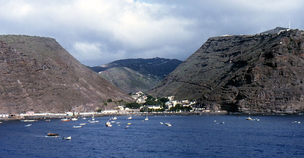
Saint Helena
1,900 km (1,200 mi) from Africa
This remote volcanic and tropical island is part of the same group of British Overseas Territories that encompasses Tristan da Cunha, though it has a much larger population than Tristan, at 4,439 people as of 2021. And, surprisingly, it’s played a key part in Western history.
 NASA Expedition 19 crew., Wikimedia Commons
Saint Helena History
When the Portuguese spotted the island in 1502, it was uninhabited. They brought livestock and built a chapel and some homes, beginning a long history of the island being used as a stopover for trade routes. Eventually, Dutch traders and pirates pushed the Portuguese and Spanish out. Its part on the trade routes went on for centuries, until the Suez Canal was open—but that’s not really what it’s known for.
Sadly, after it became a British colony, they used Saint Helena for the slave trade, and committed horrific atrocities on the island.
 Andrew Neaum, CC BY-SA 3.0, Wikimedia Commons
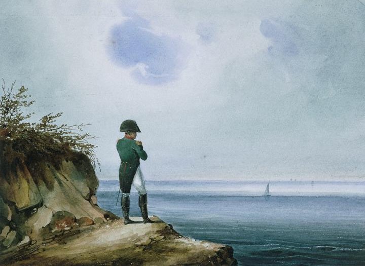
Napoleon’s Exile
After the Battle of Waterloo, his second abdication, and his ultimate surrender, Napoleon Bonaparte was sentenced to exile. The British chose Saint Helena as the place to send him, and the once-famed ruler spent his six final years on this Earth there.
 František Xaver Sandmann, Wikimedia Commons
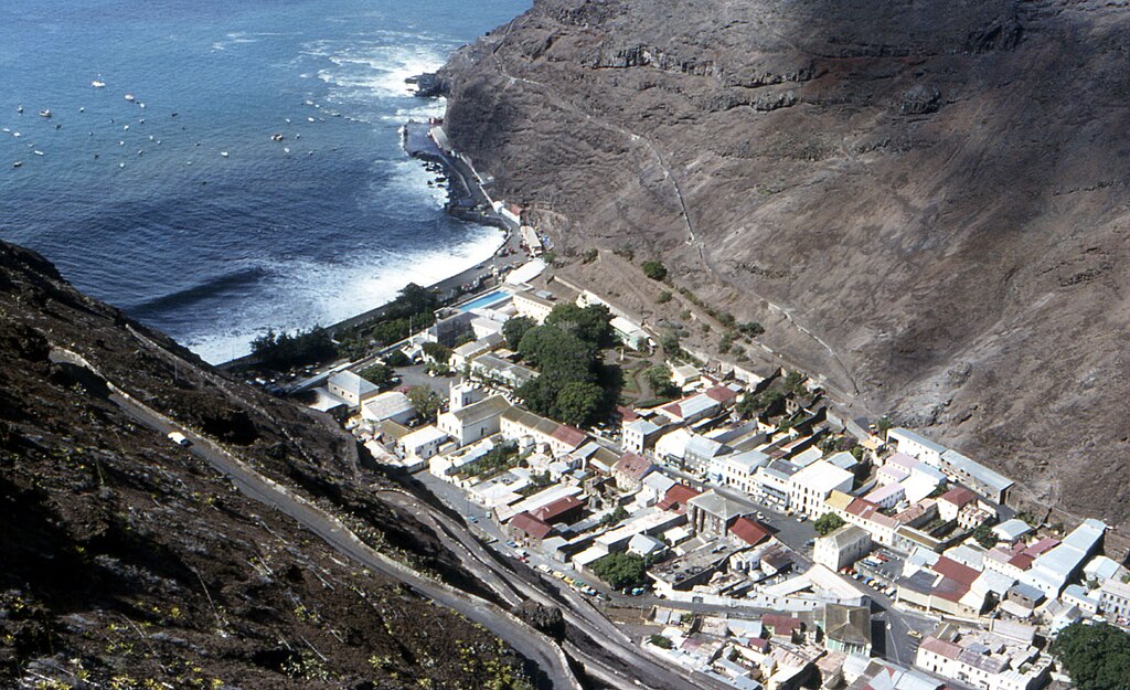
Saint Helena Features
Saint Helena has towering cliffs, rugged terrain, green valleys, and breathtaking sea views. The coasts are warm and dry, while the inland is lush with vegetation. Over the years, settlers brought in flora and fauna, pushing out some native species, though others, including many birds and vascular plants, have stood the test of time.
 Peter Neaum, CC BY 2.0, Wikimedia Commons
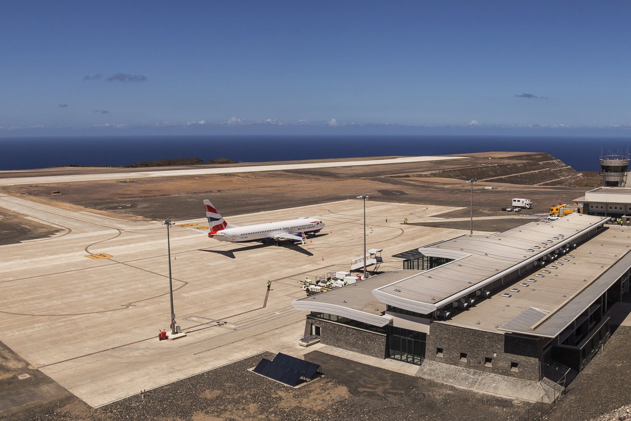
How To Get To Saint Helena
Until recently, you had to reserve a trip on the RMS St Helena to get there, a six-day journey from Cape Town. But finally, an international airport, the Saint Helena Airport, opened in 2017, allowing visitors flying through South Africa or Namibia to make their way to the isolated island.
 Paul Tyson, CC BY 3.0, Wikimedia Commons
Staying In Saint Helena
The island attracts tourists interested in the connection to European history, as well as nature lovers looking to bird watch, swim with whale sharks, or scuba dive. As such, there are a number of hotels, B&Bs, and homestays on offer.
 Andrew Neaum, CC BY-SA 3.0, Wikimedia Commons
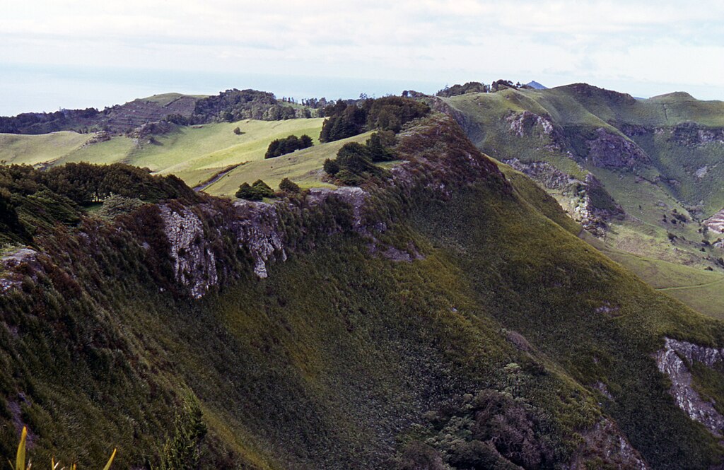
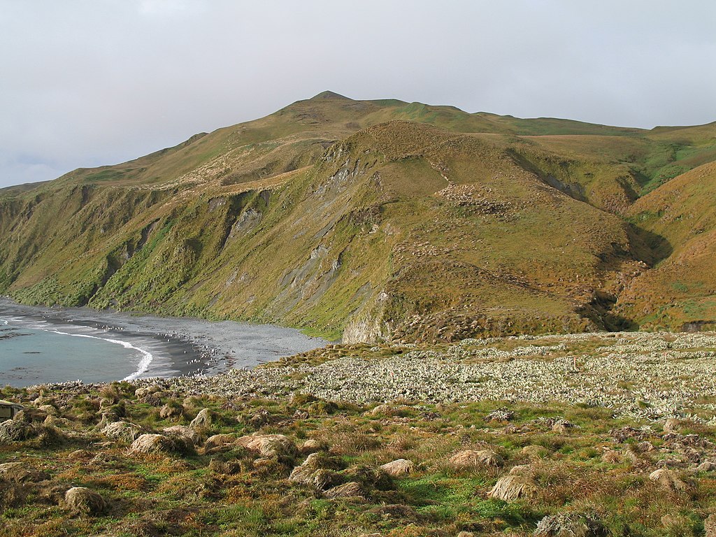
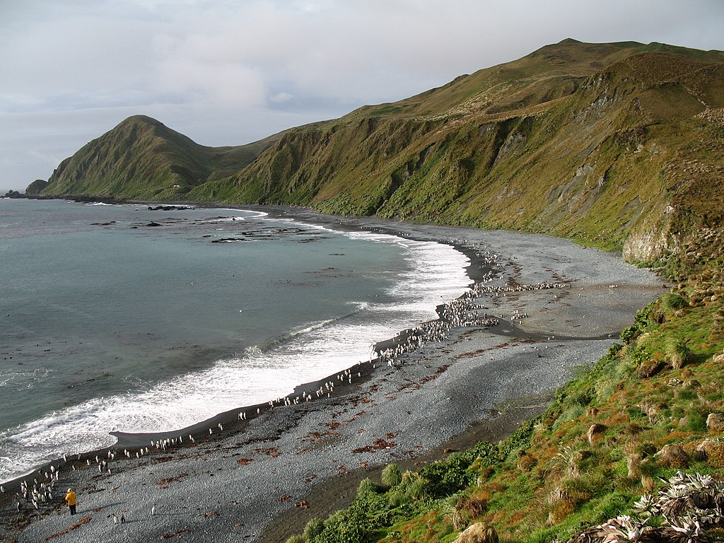
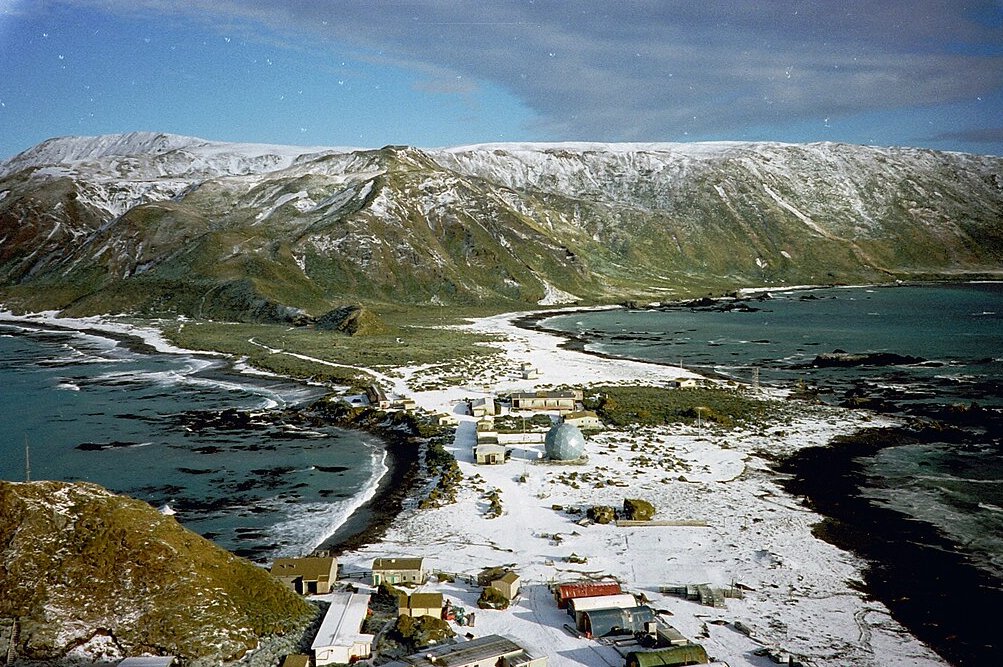
Macquarie Island
1,500 km (930 mi) from Australia
Another subantarctic island, Macquarie Island is in the Southern Ocean between Antarctica and New Zealand, and is governed as part of the Australian state of Tasmania.
 NASA Earth Observatory, Wikimedia Commons
Macquarie Island History
Though it’s never sustained a long-term population, the sealing and whaling industries have attracted people to Macquarie Island in the late 19th and early 20th centuries.
 State Library of New South Wales, Wikimedia Commons
Macquarie Island Features
Despite its harsh climate, Macquarie Island has an incredible amount of biodiversity, and is home to massive populations of seabirds in its wetlands, jagged coastline cliffs, and grasslands. As such, it has been named a UNESCO World Heritage Site.
How To Get To Macquarie Island
Macquarie Island is sometimes listed as a stopover on the way to Antarctica for boats departing from Australia or New Zealand, though many are deterred by the incredibly rough waters of the Southern Sea. Thanks to the rough coastline, smaller boats will transport visitors from the larger boat to the islands.
Staying In Macquarie Island
Though you can visit Macquarie Island and see the seals and penguins, and you can hang out at the research station to learn, visit the gift shop, and get a cup of coffee, there’s nowhere for visitors to stay on Macquarie Island.
 Hullwarren, CC BY-SA 3.0, Wikimedia Commons
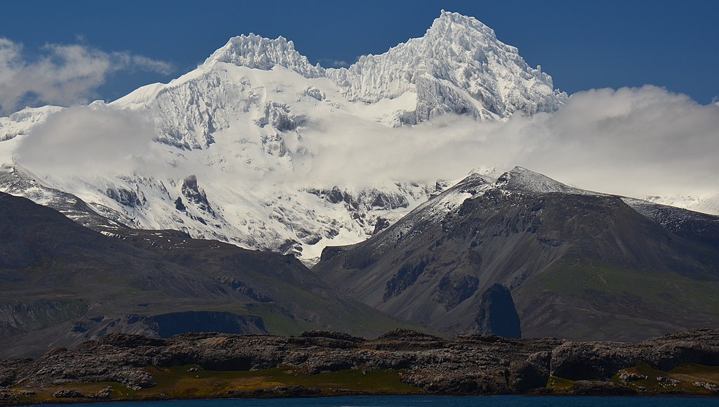
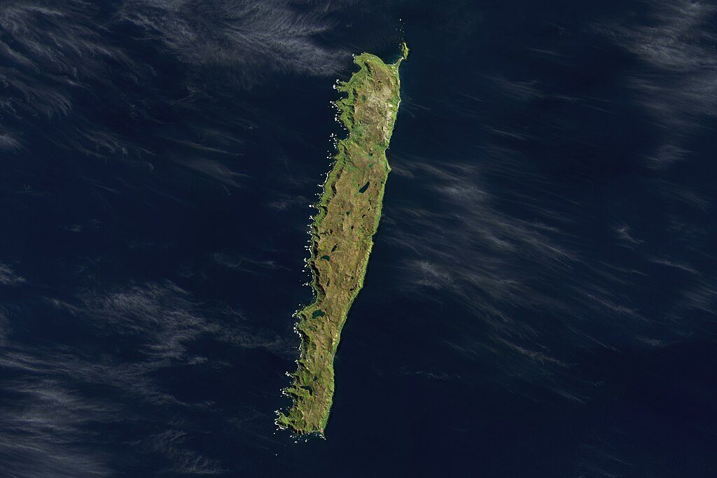
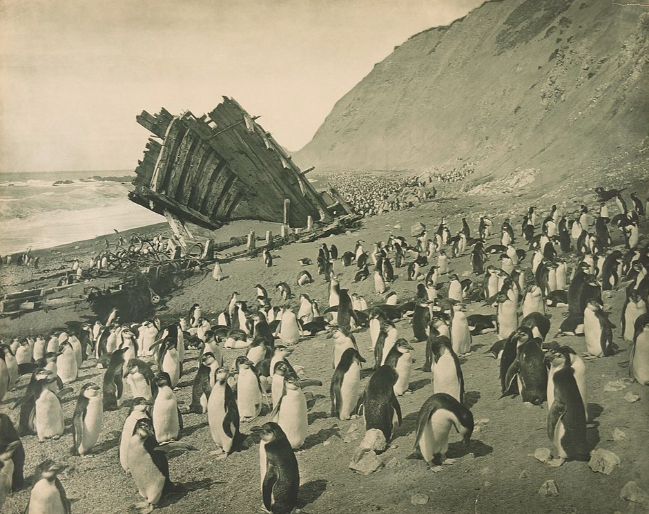
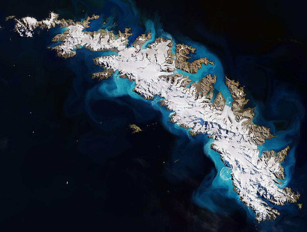
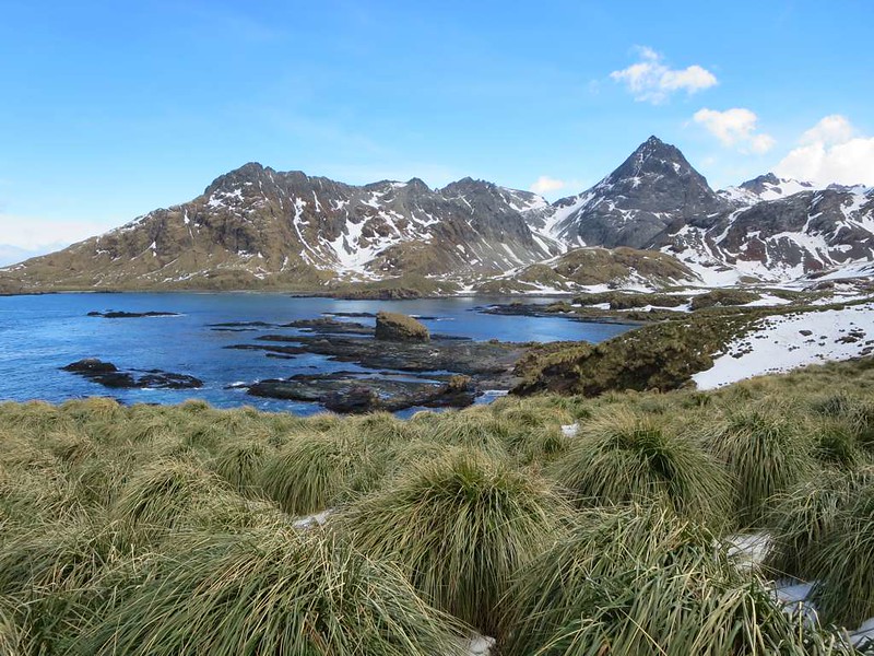
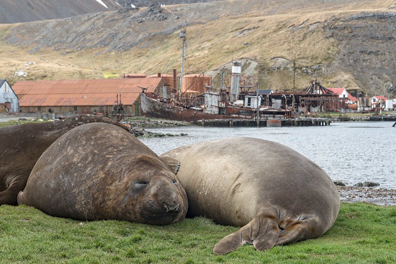
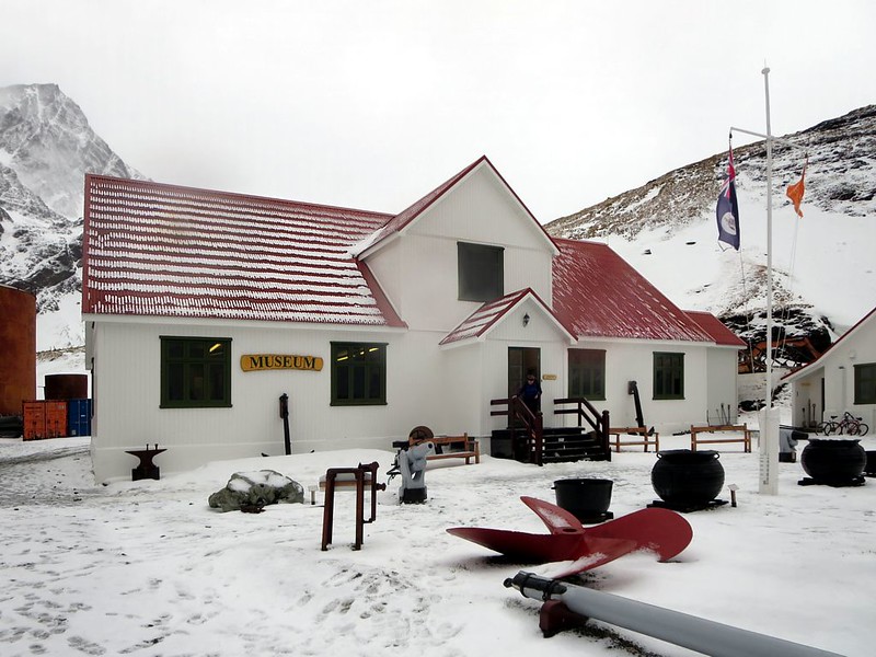
South Georgia Island
2,000 km (1,200 mi) from South America
This mountainous island is another British Overseas Territory, some 1,400km from the Falkland Islands. It’s about 170 km long and 35 km wide, marked by glacier-peaked mountains, and has numerous ports.
 European Space Agency, Wikimedia Commons
South Georgia Island History
Discovered in 1865, South Georgia Island was later landed on for the first time and mapped by Captain James Cook, who took possession of the island for England. Though Argentine naval forces briefly occupied the island during the Falklands War, it was later retaken by British forces.
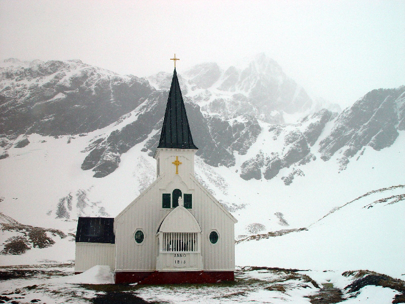
South Georgia Island Features
It’s covered in snow-tipped mountains, deep bays, and is dotted with fjords. Though the scenery is beautiful, the wildlife is even more remarkable, as South Georgia Island may have one of the highest concentrations of species in the world. Like other islands with similar climates, many penguins, seals, and whales call South Georgia Island home.
How To Get To South Georgia Island
A number of expedition and cruise companies offer stopovers on the island, though if you approach on a large ship, you’ll have to debark onto a smaller boat to reach land, where there are no roads—visitors travel on foot. And don’t you dare bring lunch—visitors aren’t permitted to bring food, as there are strict biosecurity protocols.
Staying On South Georgia Island
Thanks to its rich biodiversity, South Georgia Island is home to a number of research stations operated by a number of nations, including the United Kingdom and Argentina—though, unless you’re a scientist, you likely aren’t staying the night. Permits to stay overnight cost £1,000, so most people stay on their boats.
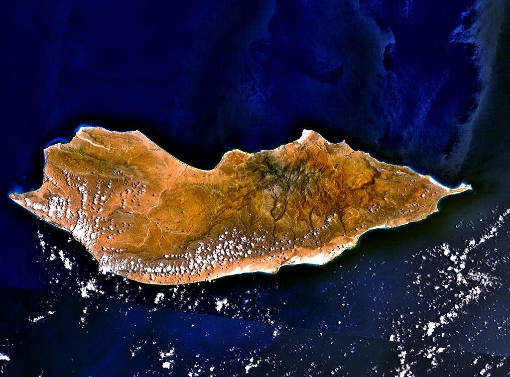
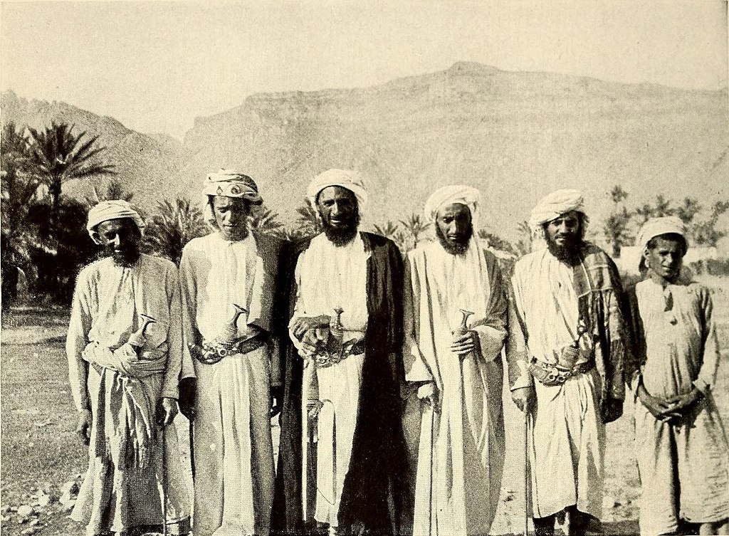
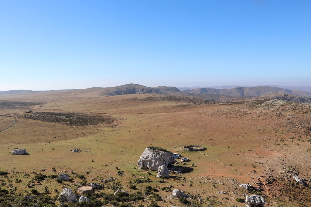
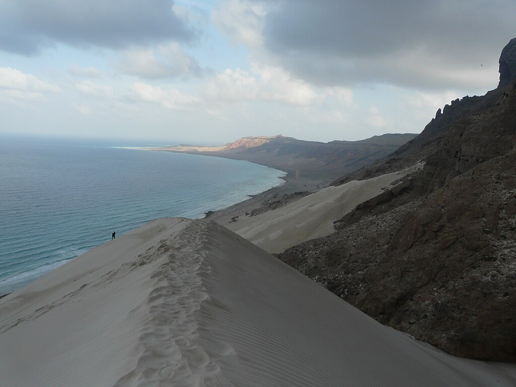
Socotra
380 km (240 mi) from Yemen
Socotra is an archipelago made up of four small islands in the Indian Ocean, and is controlled by Yemen despite being geographically part of Africa. The largest island is called Socotra Island, and it’s recognized as a UNESCO World Heritage Site.
Socotra History
Perhaps the oldest entry on this list, there’s evidence that a prehistoric culture thrived on Socotra, thanks to the archaeological discovery of primitive tools and cave inscriptions. Though the British and the Portuguese, led by the man who lent his name to Tristan da Cunha, both tried to lay claim to the island, it’s mostly been under Yemeni rule for centuries.
Since 2015, there has been a gradual takeover by the United Arab Emirates, as part of the ongoing conflict in Yemen.
 Charles K. Moser, Wikimedia Commons
Socotra Features
Unlike many of the entries on this list, Socotra was not formed by volcanoes, but instead, is a continental landform, once part of the Gondwana supercontinent. There’s the main island, and a number of smaller rocky islands and islets. The main island has coastal plains with dunes, limestone plateaus, and a central mountain range. Over a third of its local plant species cannot be found anywhere else.
 Clemens Schmillen, CC BY-SA 4.0, Wikimedia Commons
How To Get To Socotra
Travel to Socotra is currently off-limits due to deteriorating civil conditions since the outbreak of the civil war and conflict with Saudi Arabia, and it’s incredibly dangerous to even try.
 Email4mobile, Wikimedia Commons
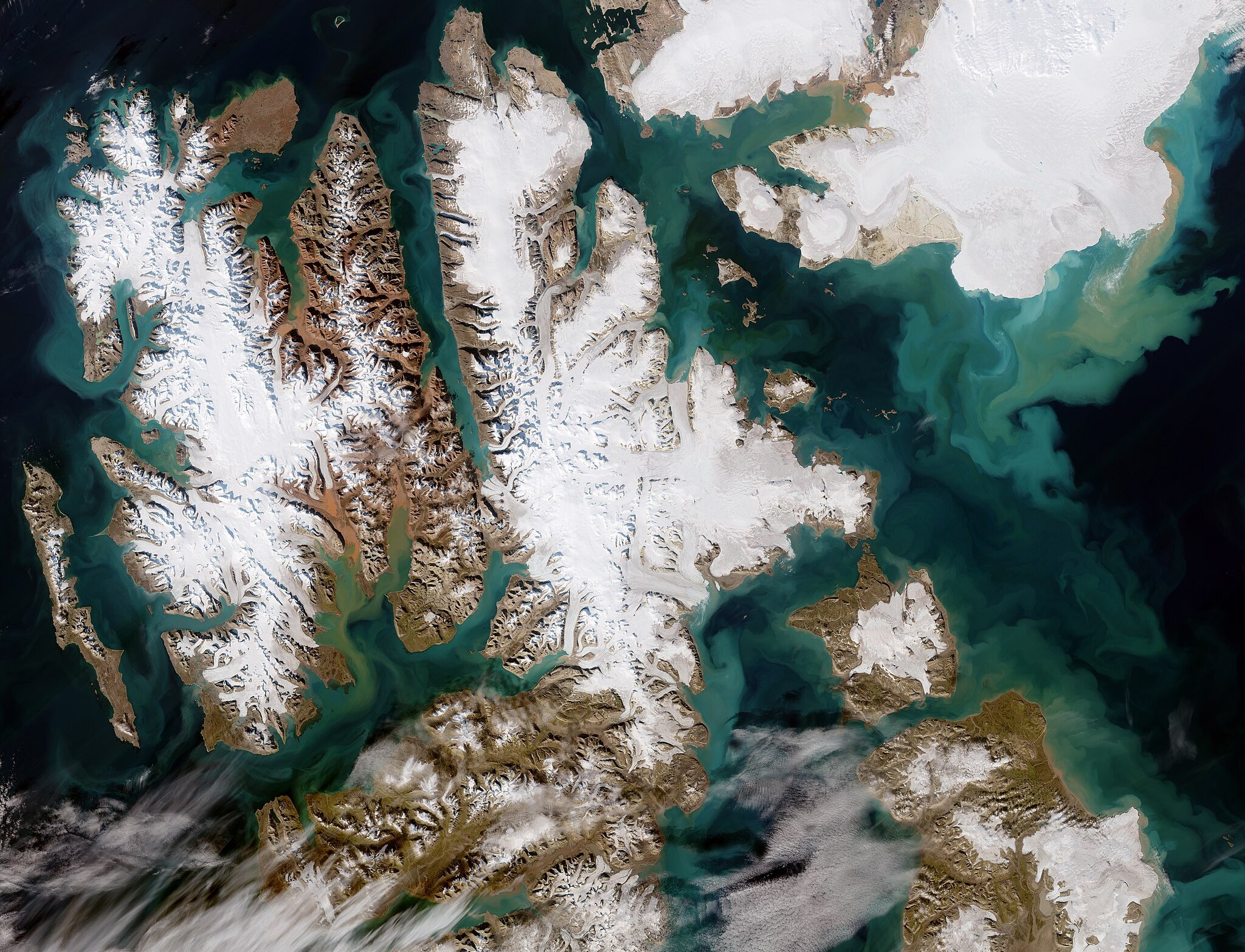
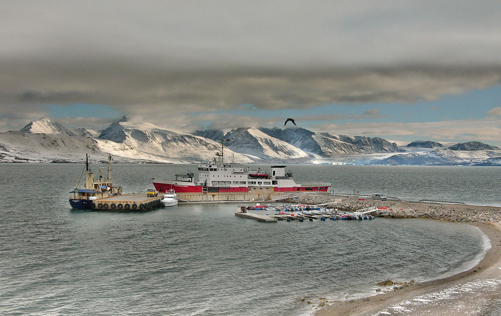
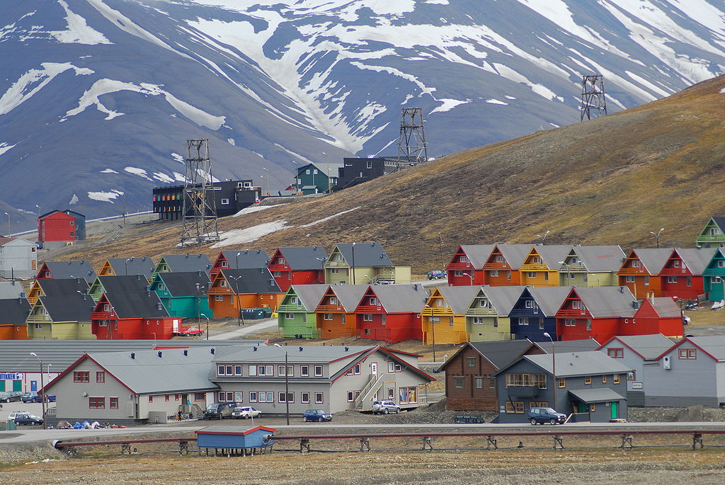
Svalbard
640 km (400 mi) from Norway
Svalbard, Norway, may be tenth on this list, but it certainly feels remote. This Arctic Ocean archipelago is halfway between Norway and the North Pole and offers adventure and variety. Spitsbergen is the only inhabited island in the archipelago and is home to the Svalbard Global Seed Bank.
 European Space Agency, Wikimedia Commonsb
Svalbard History
Though it was first spotted by the Dutch, the English were the first to touch down in Svalbard. Settlements were established by the Dutch, French, English, and Danish, followed by Russians and Norwegians interested in whale hunting in the late 17th and early 18th century. It became a destination for Arctic tourism as well as a coal mining site, and after WWI, Norway was given sovereignty over Svalbard.
 Bjoertvedt, CC BY-SA 3.0, Wikimedia Commons
Svalbard Features
Svalbard is home to the best that the Arctic Circle has to offer, with midnight sun in the summer, beautiful wildlife, and breathtaking scenery. Glaciers, mountains, and fjords—what more could one want from a visit to the Arctic Ocean? Thanks to its high latitude, well-timed visitors to Svalbard can plan around the midnight sun in the summer and experience long, gorgeous twilights.
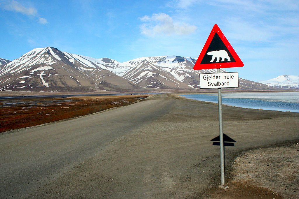
Svalbard is also home to your stereotypical—and adorable—Arctic wildlife, like reindeer, polar bears, and the Arctic fox.
 Sprok, CC BY-SA 3.0, Wikimedia Commons
How To Get To Svalbard
To protect Svalbard’s natural beauty, Norway has introduced regulations barring ships with more than 200 people on board—which mostly affect cruise ships, meaning less hordes of tourists to contend with as you might in other port cities of the north. There are daily flights to Longyearbyen, Svalbard from Oslo and Tromso.
 Hannes Grobe, CC BY-SA 2.5,Wikimedia Commons
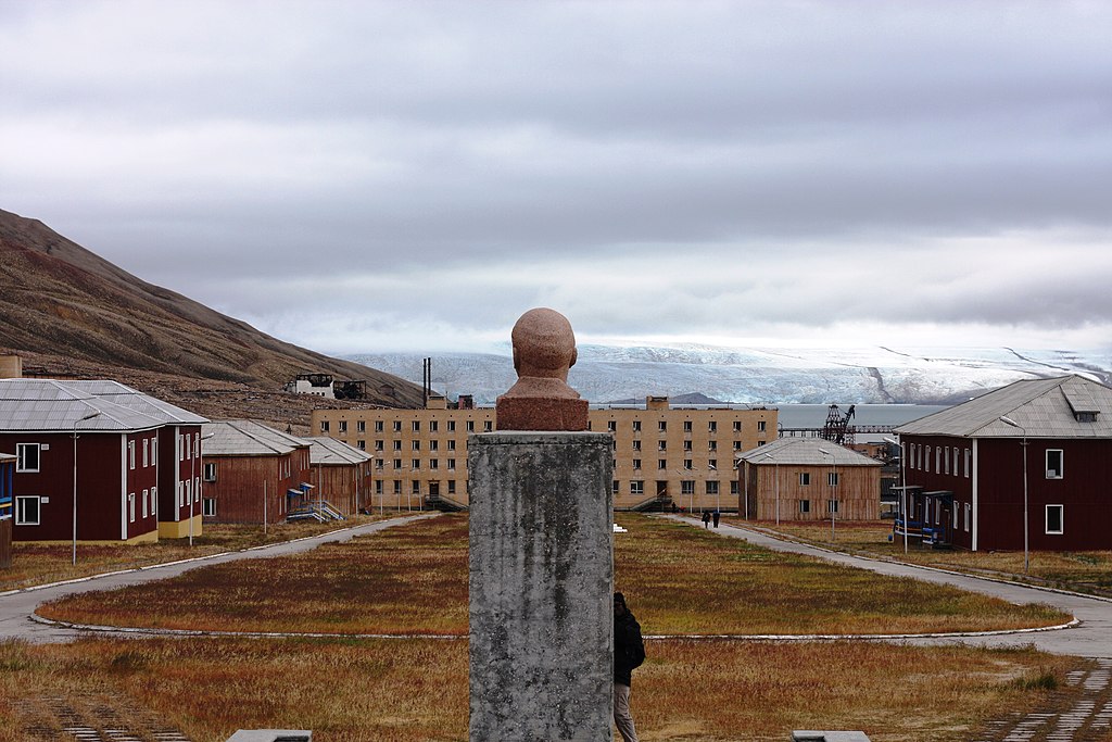
Staying In Svalbard
Most tourism is centered in Longyearbyen, the only incorporated town on Svalbard. Originally a coal-mining town, it has hotels and offers unparalleled views to the Northern Lights, which appear between late September and the middle of March.
There are other places to stay in Svalbard, including hotels meant for those taking day trips from Longyearbyen.


.jpeg)
.JPG)
.jpg)
.jpg)
.jpg)