Line Of Duty
Some borders are peaceful demarcation lines between nations, like the one between Belgium and The Netherlands. But the 13 in this article have become flashpoints of conflict and humanitarian issues.
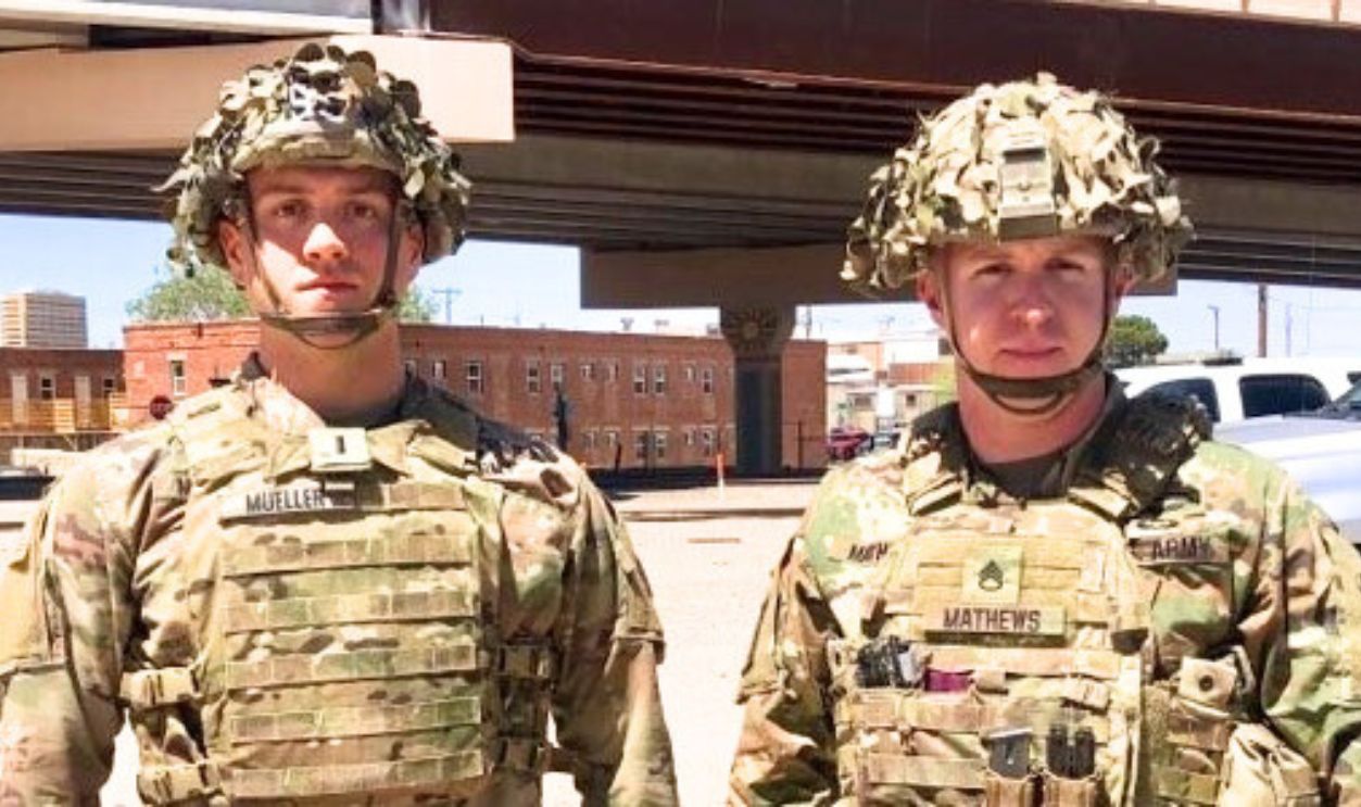
North Korea – South Korea
The Korean Demilitarized Zone, which spans approximately 250 kilometers, was created in 1953 as part of the Korean Armistice Agreement. This agreement ended the Korean War but did not result in a formal peace treaty, leaving the two Koreas technically still at war.
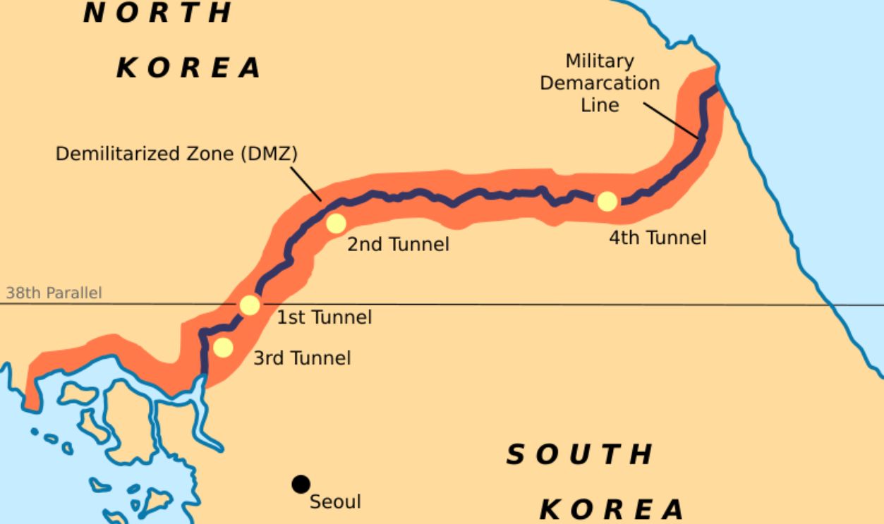 Rishabh Tatiraju, CC BY-SA 3.0, Wikimedia Commons
North Korea – South Korea (Cont.)
There have been a few significant events along this border. For instance, the Axe Murder Incident back in 1976, when two US soldiers were taken down by North Korean forces. There have also been some military tensions, such as the 2010 Yeonpyeong Island bombardment.
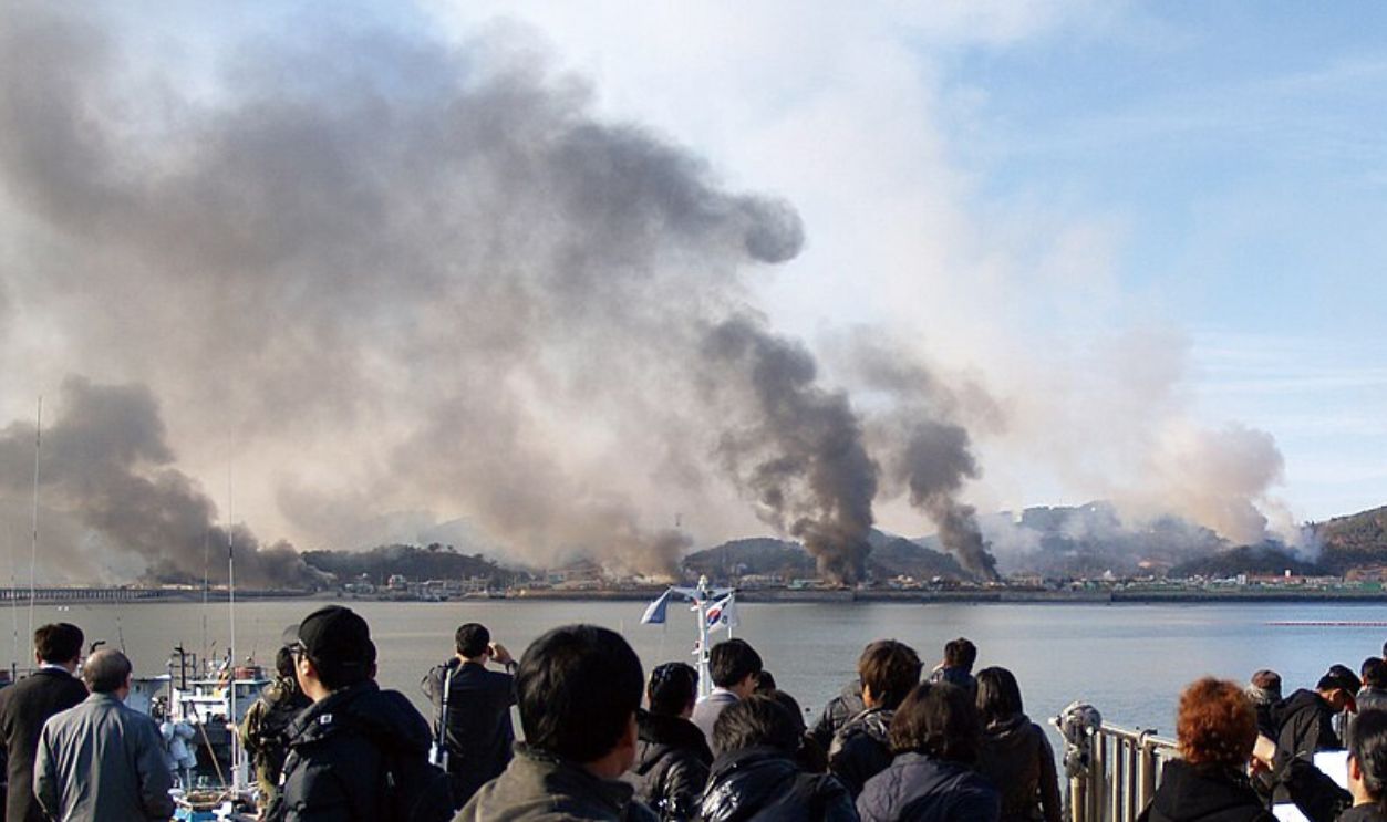 Republic of Korea Armed Forces, CC BY-SA 2.0, Wikimedia Commons
Niger – Chad
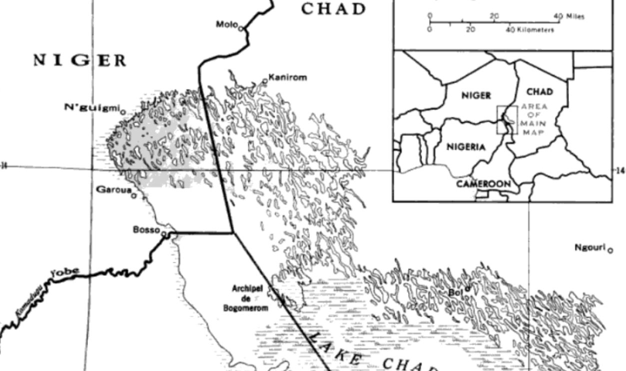
Niger and Chad both broke free from France in 1960, and that’s when their shared border became an international line. The region is said to have been affected by the activities of extremist groups such as Boko Haram and its offshoots.
Niger – Chad (Cont.)
In response to the warning given by Boko Haram, Chad has deployed troops along the border, especially in areas like Bosso. The goal of Niger and Chad's combined military actions since 2015 has been to stop insurgent activity. This frontier is about 743 miles long.
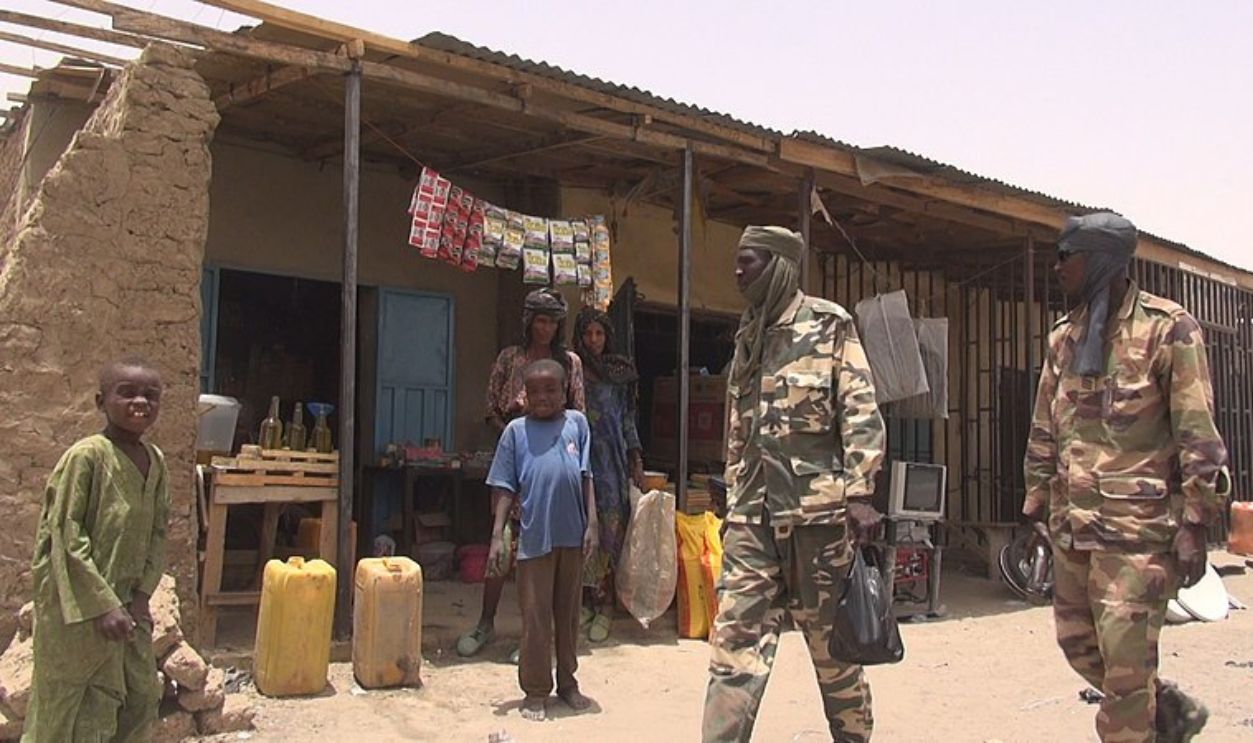 Nicolas Pinault (VOA), Wikimedia Commons
Colombia – Ecuador
This one runs from the Pacific Ocean in the west to the Amazon rainforest in the east. At the Colombia-Ecuador border, there have been some reported incidents where Colombian defense operations against FARC camps have blatantly crossed into Ecuadorian territory.
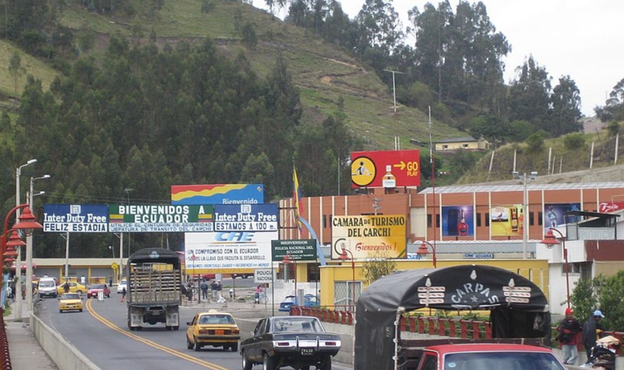 MacAllenBrothers, CC BY-SA 2.0, Wikimedia Commons
Colombia – Ecuador (Cont.)
One such incident occurred in 2008 when a Colombian military operation aimed at FARC resulted in a diplomatic crisis with Ecuador. However, the Rumichaca Bridge, which connects Tulcán (Ecuador) to Ipiales (Colombia), is said to be the most common and safest crossing point.
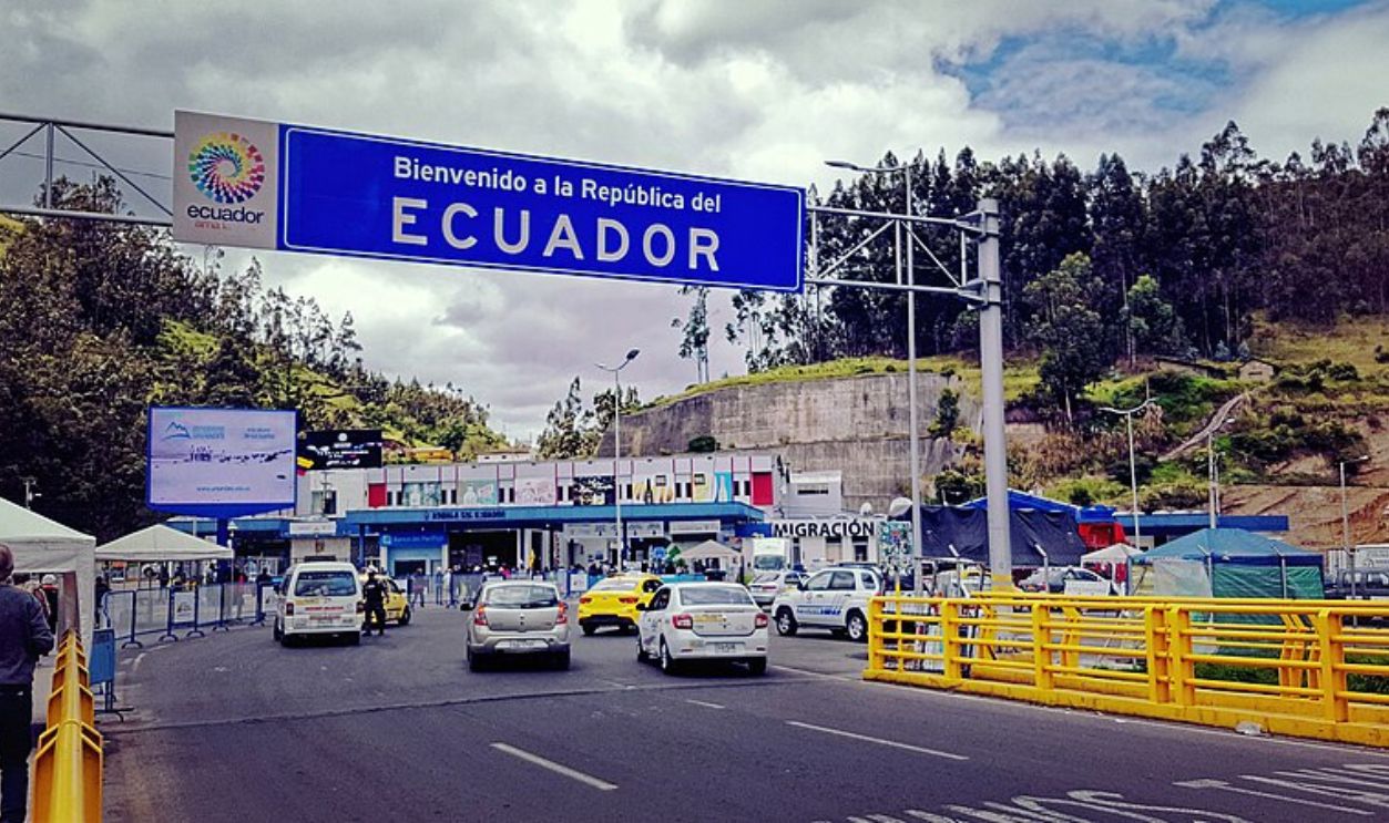 Burkhard Mücke, CC BY-SA 4.0, Wikimedia Commons
India – Pakistan
The border between the two is often referred to as the Line of Control (LoC) in the Kashmir region. This infamous conflict goes back to the partition that created India and West Pakistan. Since 1947, the region has seen three major conflicts (1947–48, 1965, and 1999) over Kashmir.
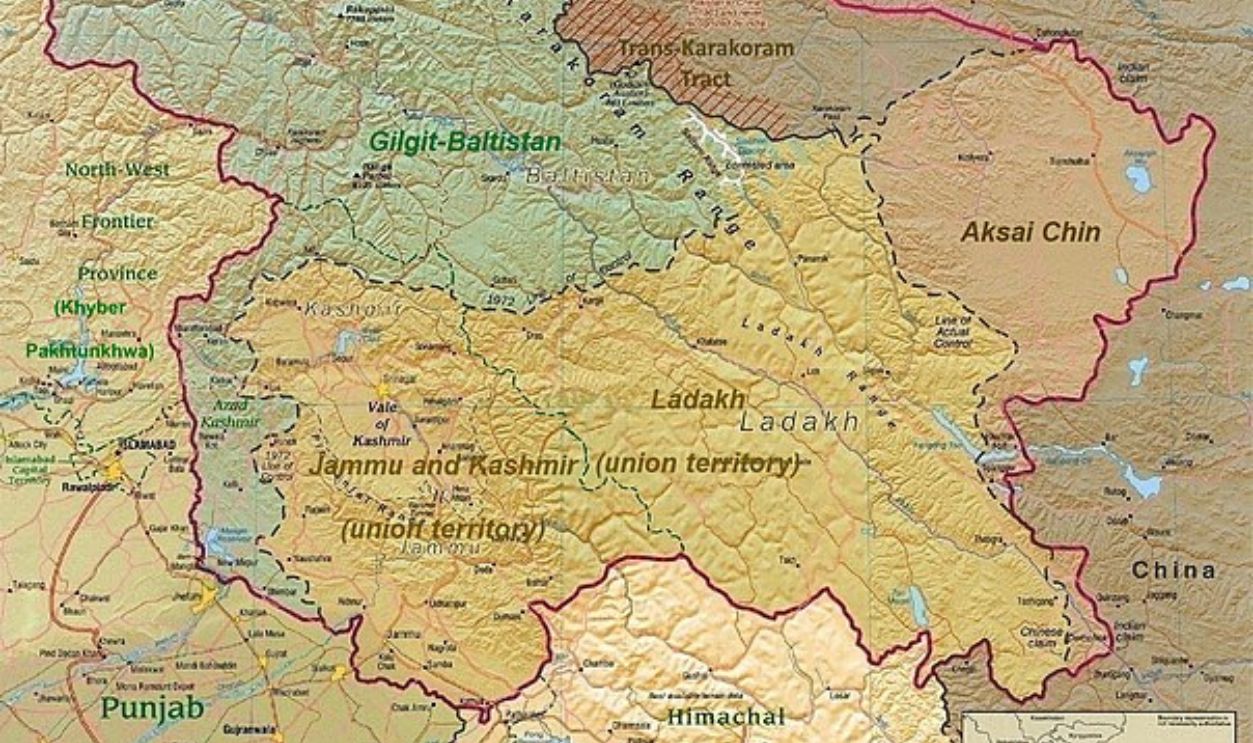 US Central Intelligence Agency, Wikimedia Commons
India – Pakistan (Cont.)
In 2019, a suicide attack in Pulwama took the lives of around 40 Indian personnel. The LoC remains a hotbed for violence, with reports indicating that hundreds have been killed or displaced due to clashes over the years. Some residents are also faced with psychological trauma.
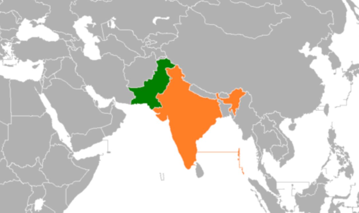 Grubb, CC BY-SA 3.0, Wikimedia Commons
Israel – Syria
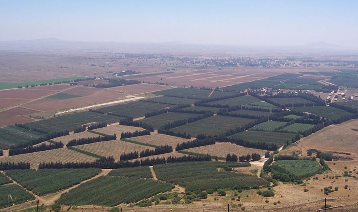
During the Yom Kippur War of 1973, Syrian forces attempted to reclaim the Golan Heights. This had caused some heavy casualties. Although Israel retained control, the conflict highlighted the volatility of this region. The border between Israel and Syria is known as the Golan Heights.
 Masterpjz9, CC BY-SA 2.5, Wikimedia Commons
Israel – Syria (Cont.)
So, the Golan Heights was captured by Israel during the Six-Day War in 1967 and later annexed in 1981, a move that was unilateral in nature. Besides, the area's elevation makes it strategically important, with a stunning view of southern Syria and northern Israel.
 Ilan Bruner, CC BY-SA 3.0, Wikimedia Commons
Yemen – Saudi Arabia
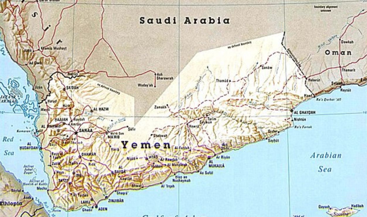
Since 2014, Yemen has been caught up in a civil conflict with different groups fighting for power. The Houthi rebels, in particular, have taken over a part of northern Yemen. They have even launched missile strikes and drone attacks against Saudi targets.
Yemen – Saudi Arabia (Cont.)
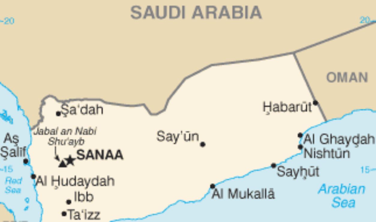
This border runs from the Red Sea coast in the west to the tripoint with Oman in the east. It came about by several treaties, most notably the 1934 Treaty of Taif and the 2000 Treaty of Jeddah, which fixed the present location of the frontier.
China – North Korea
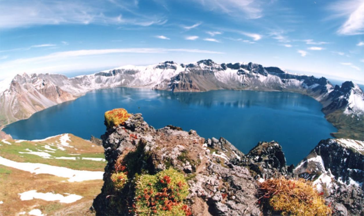
The current border was set by secret deals made between China and North Korea in 1962 and 1964. These treaties outlined the boundaries along the Yalu and Tumen rivers. They ended up favoring North Korea and gave it control over the area around Paektu Mountain.
 Bdpmax, CC BY-SA 3.0, Wikimedia Commons
China – North Korea (Cont.)
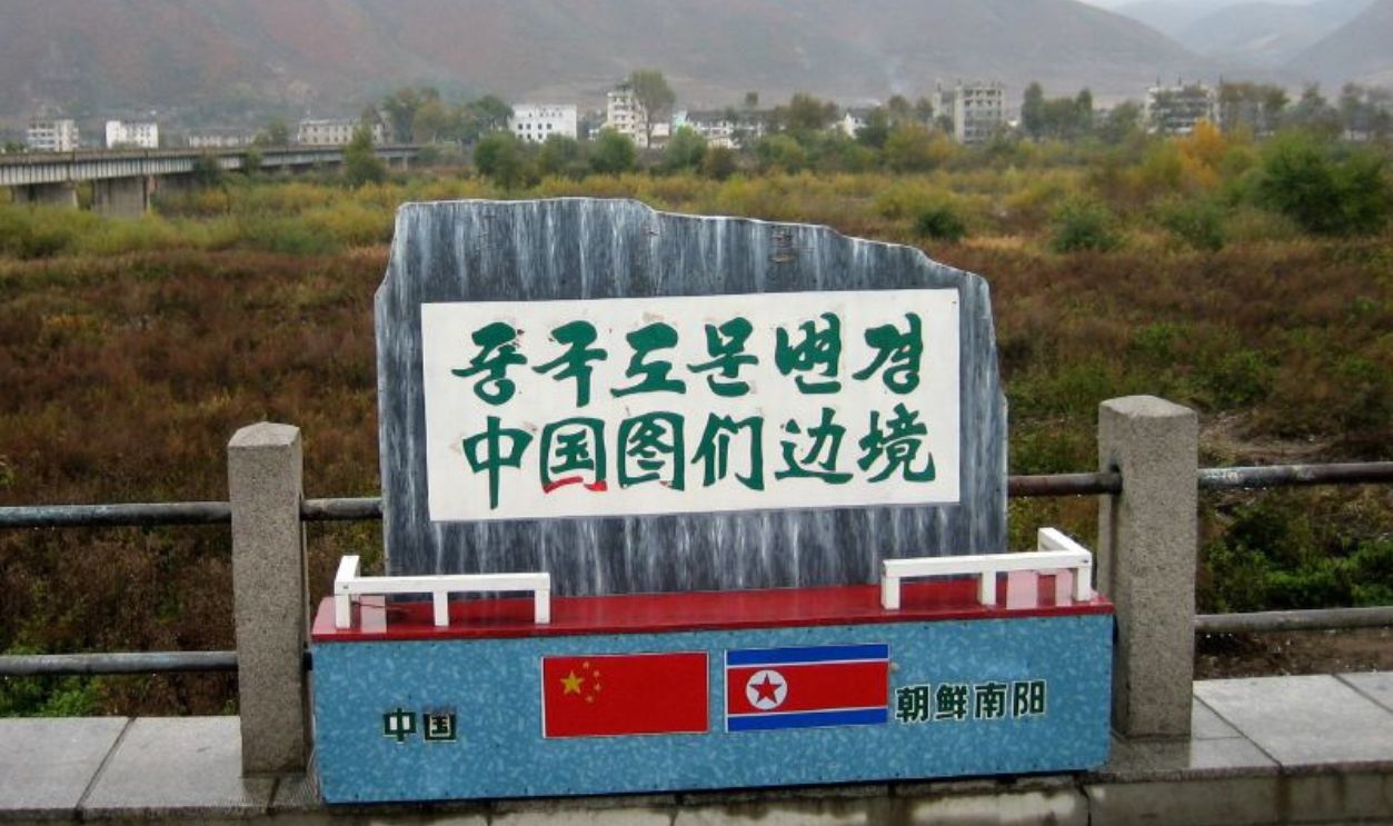
This China-North Korea border has typically been described as "porous”. It is basically seen as a pathway for people trying to escape the tough life in North Korea. The border is also very important for North Korea's economy because it is the main way they trade with China.
 Prince Roy, CC BY 2.0, Wikimedia Commons
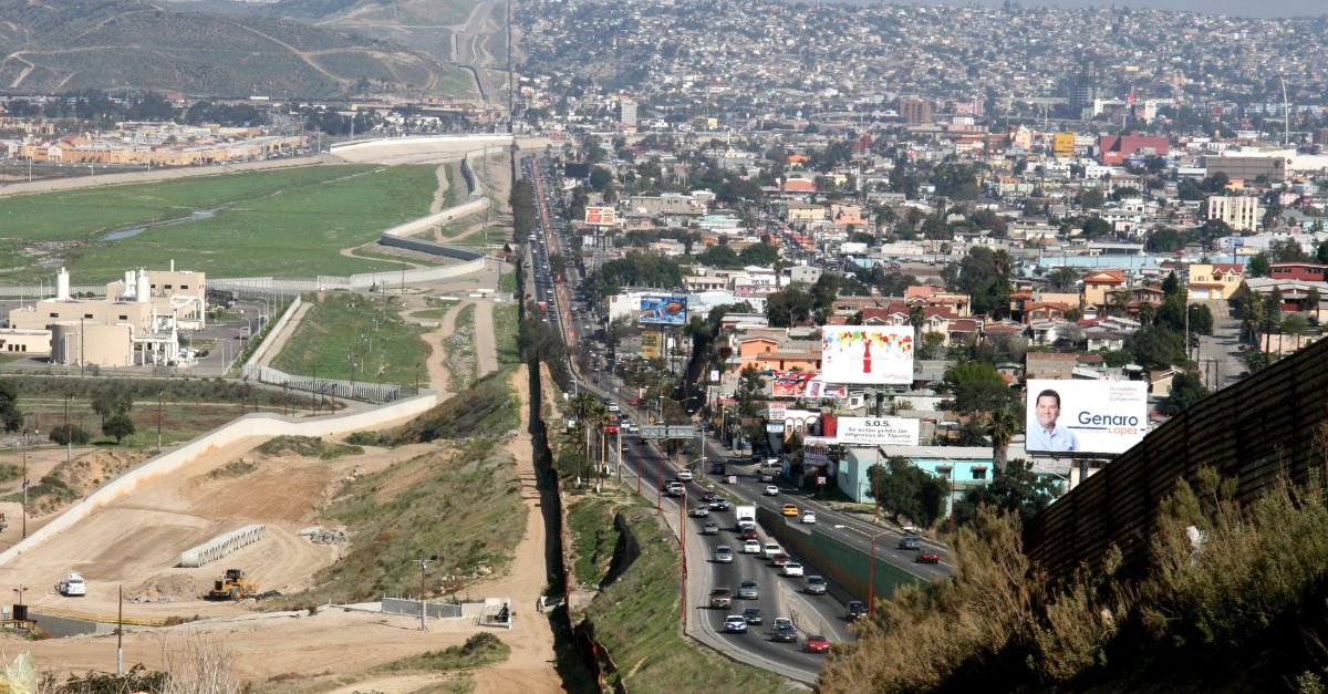
Mexico – United States
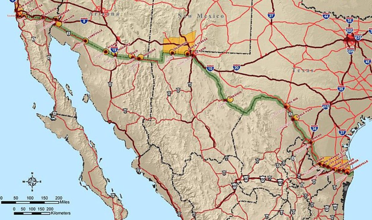
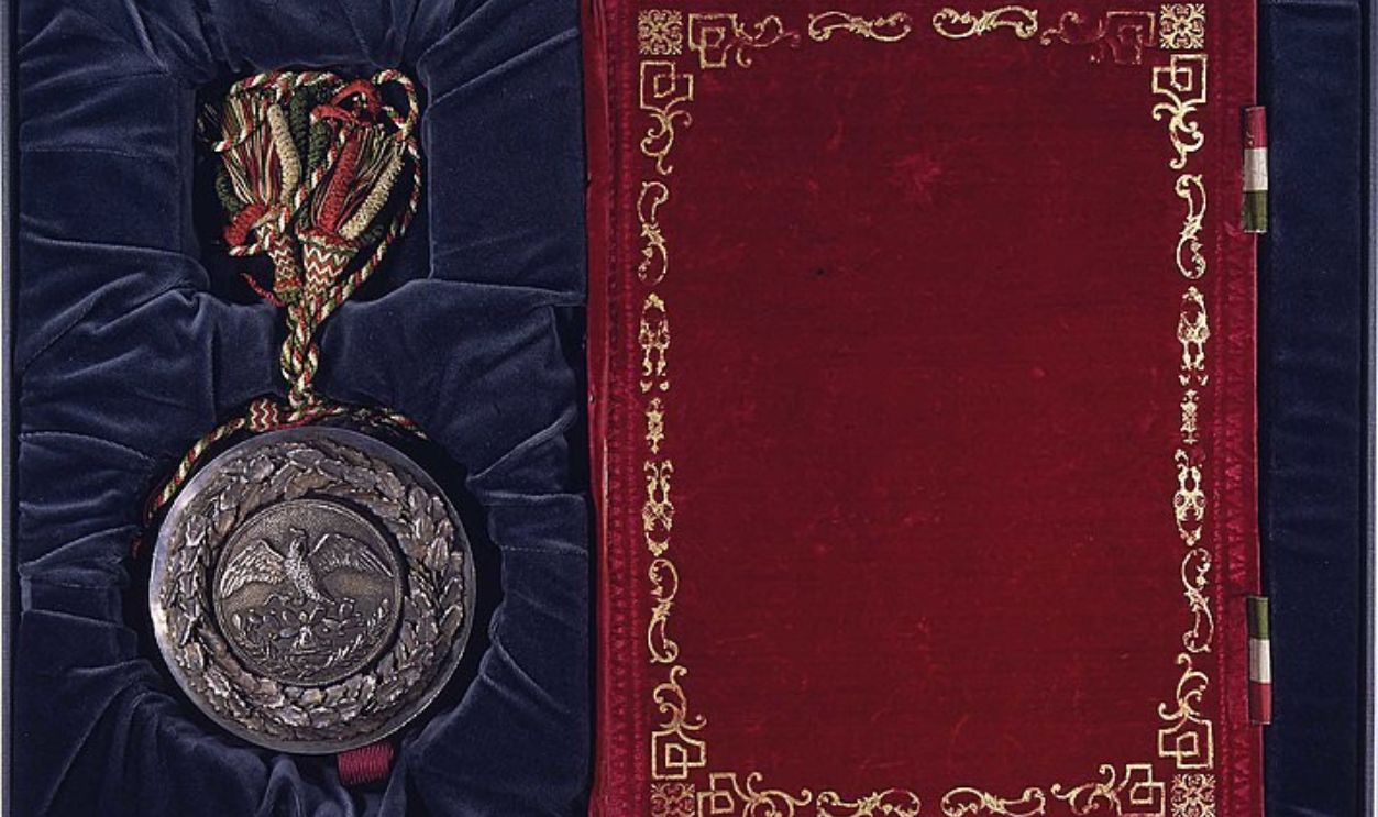
The partition we know today was set up after the Mexican-American War, which lasted from 1846 to 1848. The 1848 Treaty of Guadalupe Hidalgo formally made it happen, and as a result, Mexico handed over a large chunk of land to the US.
 Governments of USA and Mexico, Wikimedia Commons
Mexico – United States (Cont.)
A strategy called "Prevention Through Deterrence" has pushed migrants into much riskier areas, making it way more likely for them to face death or go missing. Human Rights Watch points out that these policies have truly added to a public health crisis.
Bangladesh – India
This happens to be one of the longest and most complex international borders in the world. It is about 4,096 kilometers long. The partition was first marked during the partition that created India and (formerly) East Pakistan with visible demographic shifts and communal violence.
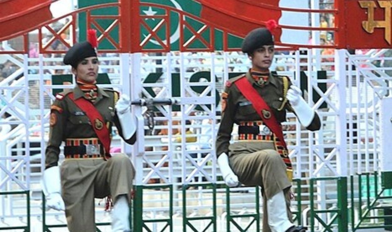 Koshy Koshy, CC BY 2.0, Wikimedia Commons
Bangladesh – India (Cont.)
The Indian Border Security Force (BSF) has a pretty controversial "shoot-on-sight" policy to try to stop people from crossing the border illegally. Reported estimates suggest that around 1,000 Bangladeshi civilians were killed by BSF between 2001 and 2010.
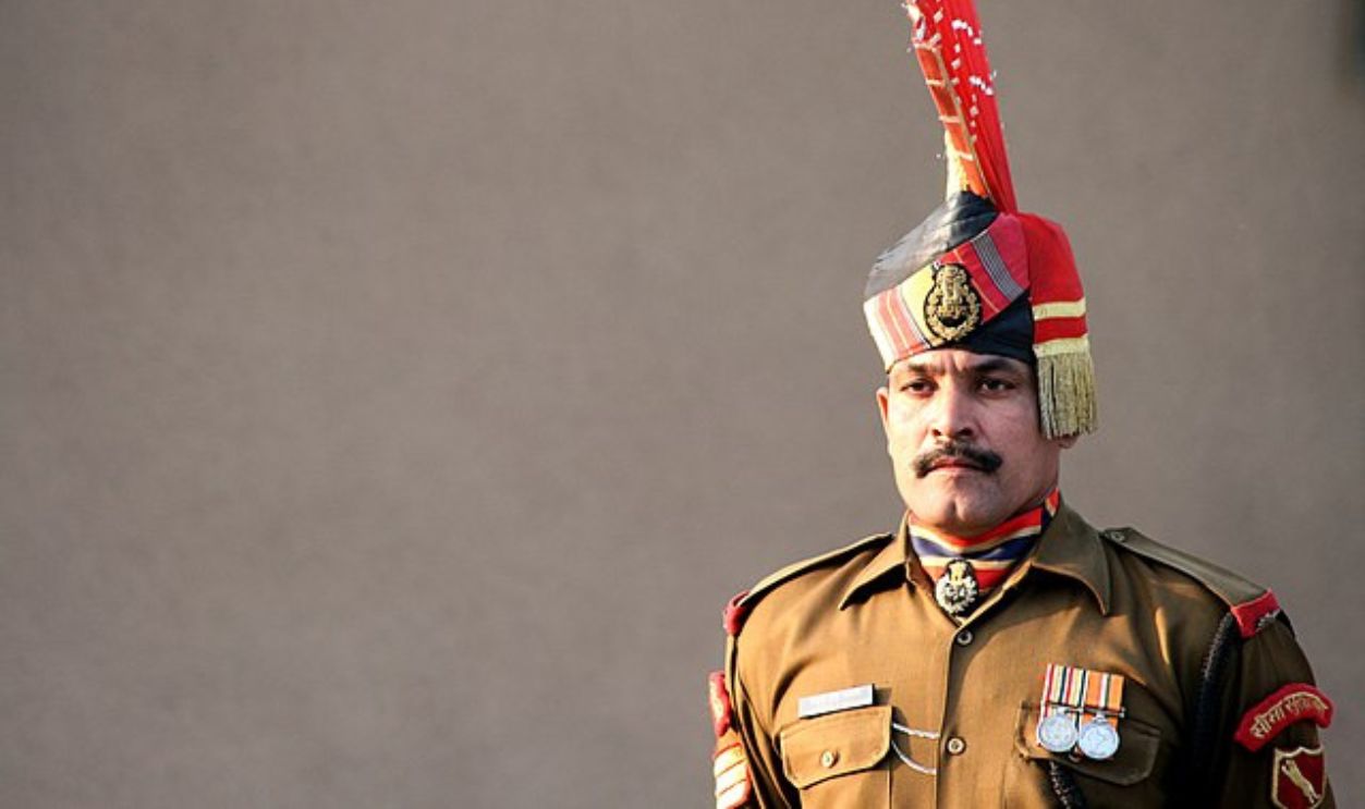 Still Thinking, CC BY-SA 2.0, Wikimedia Commons
Pakistan – Afghanistan
The Durand Line, as the border is famously known, was established in 1893 through an agreement between Sir Mortimer Durand, representing British India, and Abdur Rahman Khan, the Amir of Afghanistan. This was meant to separate the areas where the British and Afghans had their influence.
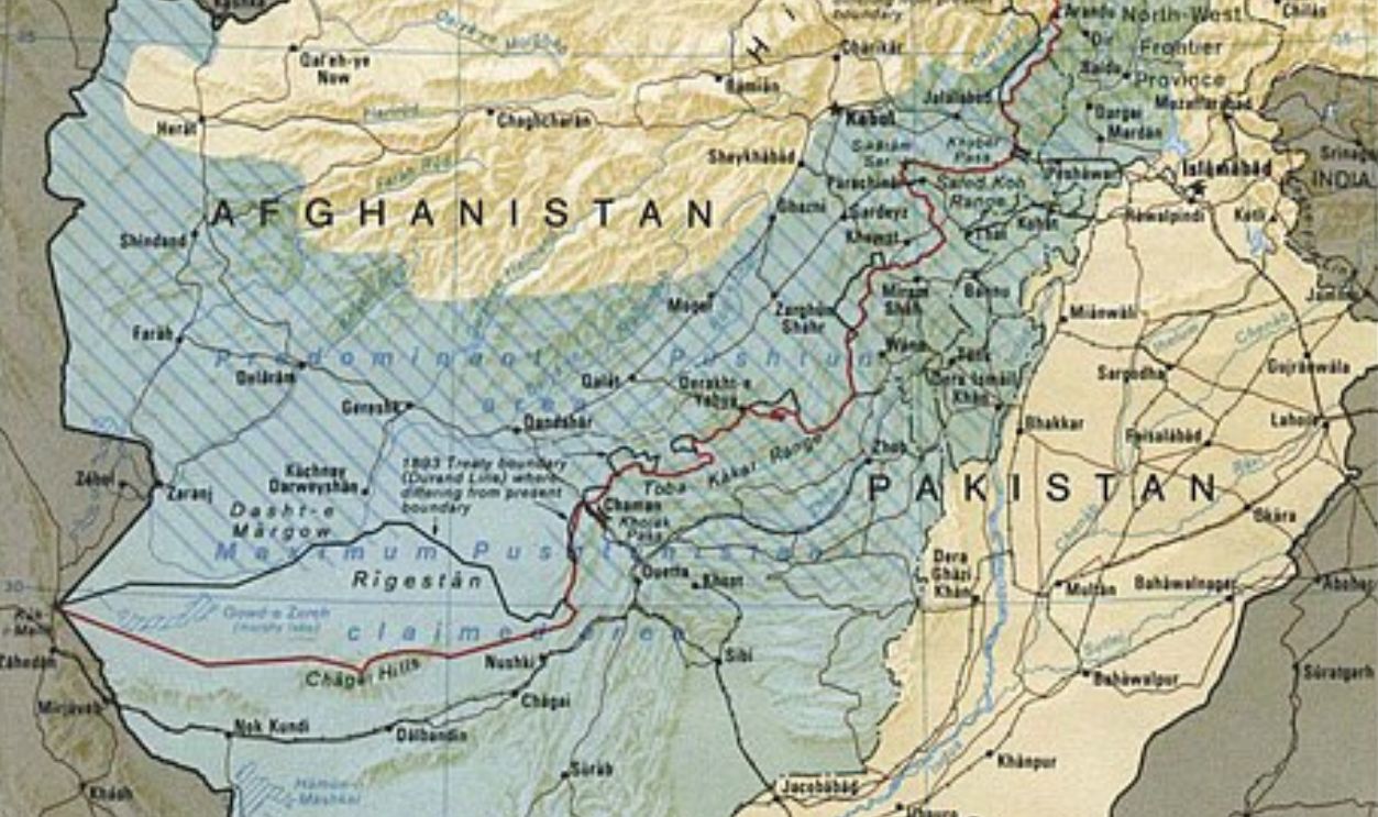 Central Intelligence Agency, Wikimedia Commons
Pakistan – Afghanistan (Cont.)
Both sides suffered losses when vigorous combat broke out between Pakistani and Afghan forces in the Kurram-Khost region in September 2024. The violence has been linked to disagreements over border development projects and Pakistan's claims that militants from Afghanistan are attacking its territory.
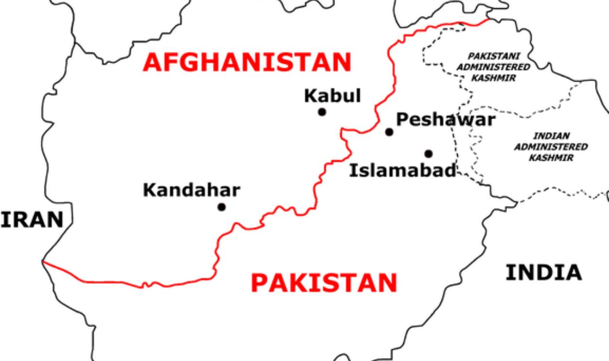 Weaveravel, CC BY-SA 4.0, Wikimedia Commons
Iraq – Iran
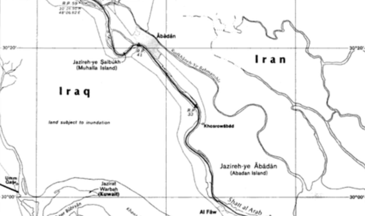
Although this boundary was first laid out in the Treaty of Zuhab in 1639, there have been numerous disagreements over the years, especially regarding the Shatt al-Arab waterway. The Shatt al-Arab is created by the convergence of the Tigris and Euphrates rivers and empties into the Persian Gulf.
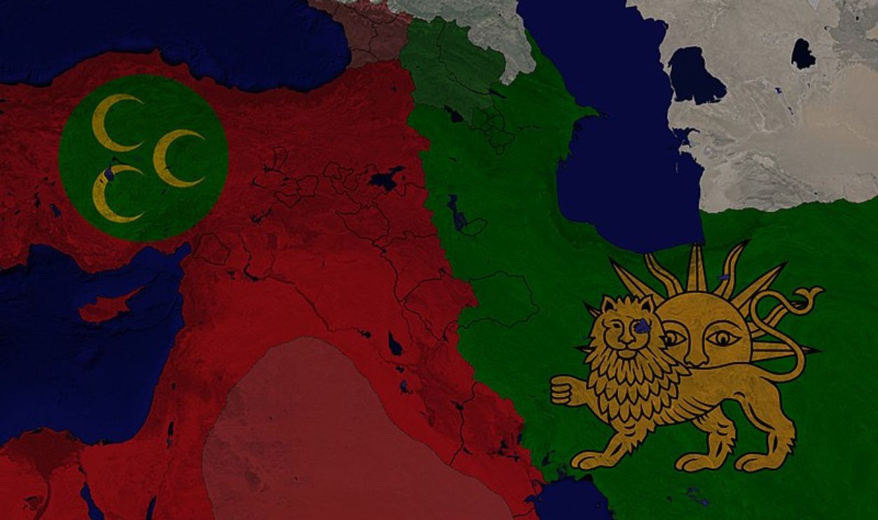 Daddok9301, CC BY-SA 4.0, Wikimedia Commons
Iraq – Iran (Cont.)
The 1937 Treaty decided that the partition would be along the eastern bank of the river, but this has caused big issues for Iran. They believe it should follow the Thalweg principle, which means the boundary should go along the deepest part of the river instead.
Russia – Ukraine
Ukraine became an independent nation after the Soviet Union broke up in 1991, and its borders were acknowledged globally. Russia, meanwhile, has a history of being hesitant to recognize Ukraine's territorial integrity. In 2014, Russia annexed Crimea following a disputed referendum.
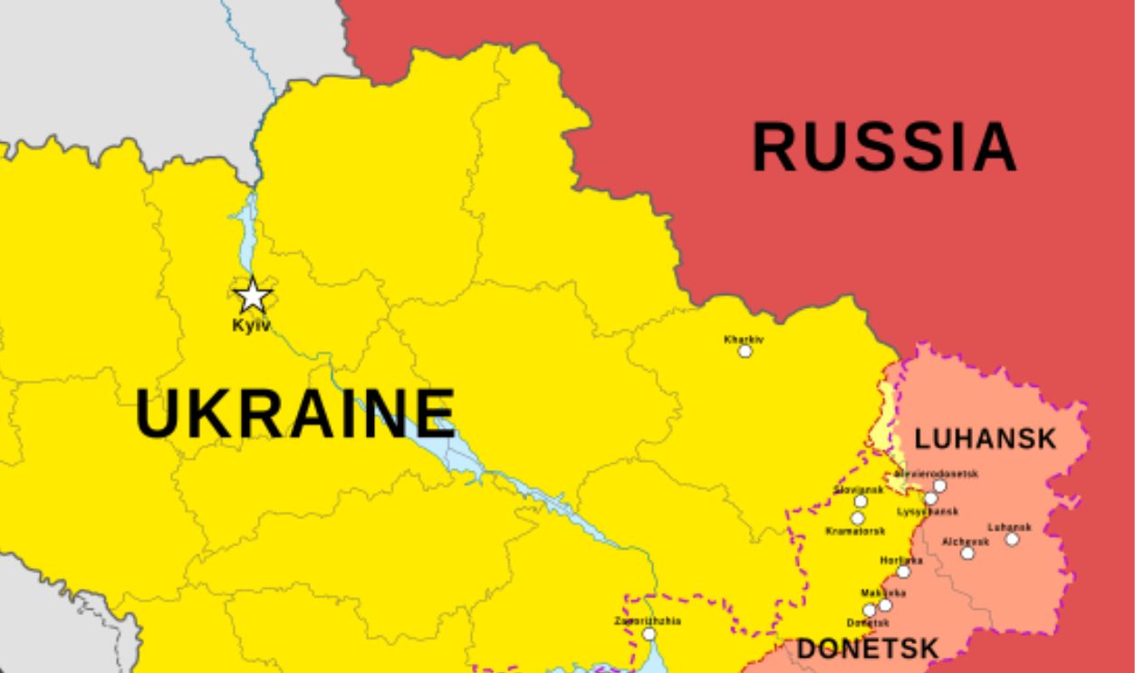 Basque mapping, CC BY-SA 4.0, Wikimedia Commons
Russia – Ukraine (Cont.)
What resulted from this act were severe tensions between Russia and Ukraine, which was against international law. Ukrainian forces have also carried out certain cross-border attacks into Russian territory. Their focus was on areas like Kursk and Belgorod. Russia obviously retaliated, which we see in the news today.
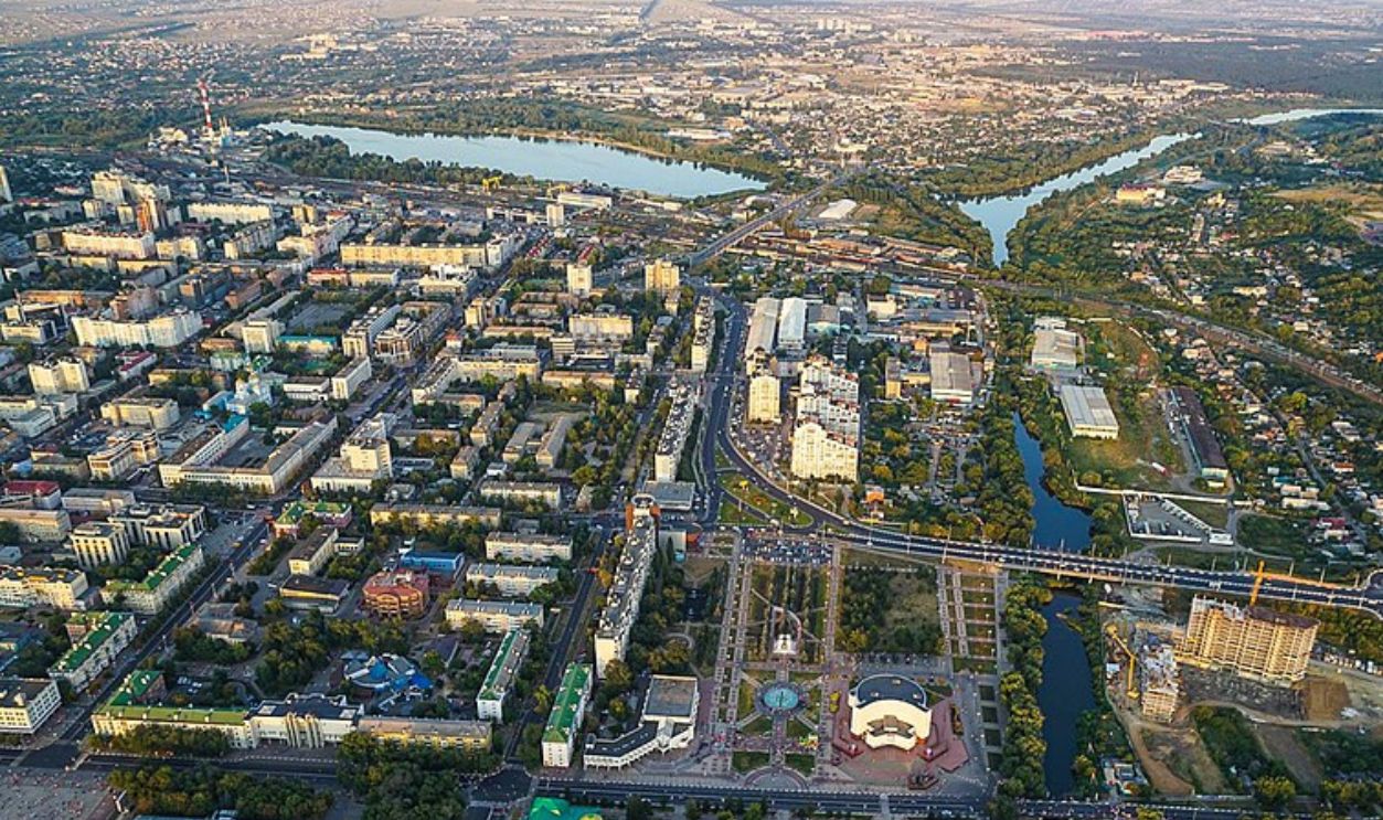 Dmitry Romanenko, CC BY-SA 3.0, Wikimedia Commons
Ethiopia – Eritrea
This modern border started taking shape in the late 1800s when Eritrea became an Italian colony. The Treaty of Wuchale in 1889 officially recognized Eritrea as part of Italy, but it also had some confusing parts about Ethiopia's autonomy. This led to the First Italo-Ethiopian War.
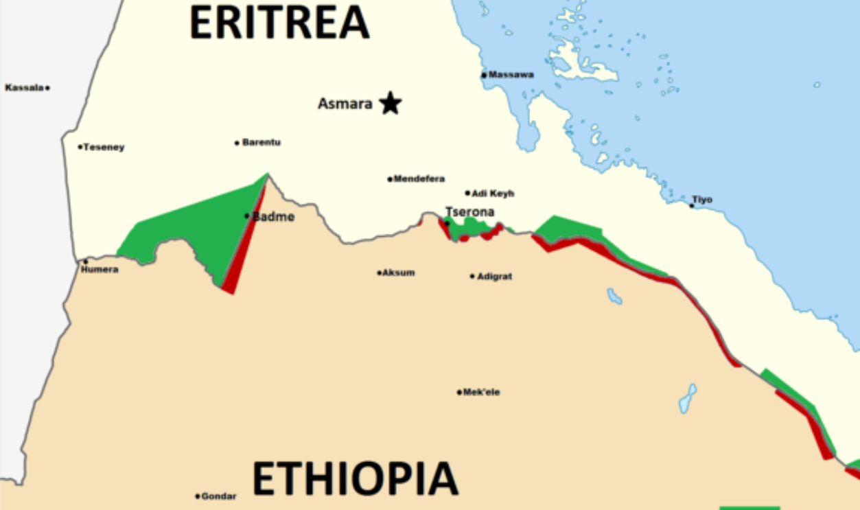 Skilla1st, CC BY-SA 3.0, Wikimedia Commons

